
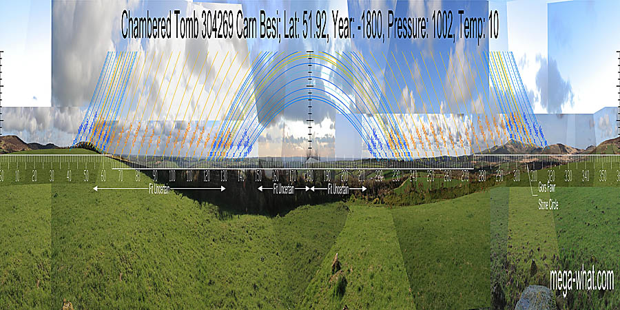
 Carn Besi Chambered Tomb lies close beside the A478 between Llandisilio and Crymych in Carmarthenshire, West Wales.
The classification as a Chambered Tomb is conjectural as it is very badly damaged, possibly as a result of being robbed for stone by the road builders.
Carn Besi Chambered Tomb lies close beside the A478 between Llandisilio and Crymych in Carmarthenshire, West Wales.
The classification as a Chambered Tomb is conjectural as it is very badly damaged, possibly as a result of being robbed for stone by the road builders.
 South is in a dip [Pic]. The southern horizon is very distant and fairly uniform.
Thus the profiles of nearer hills may make more reliable markers in this direction.
South is in a dip [Pic]. The southern horizon is very distant and fairly uniform.
Thus the profiles of nearer hills may make more reliable markers in this direction.
![[Pic].](CarnBesi-S.jpg)
North is on a hilltop [Pic]. The north-eastern lunisticeLunistices are the most northerly and southerly moons of the month. The lunar equivalent of solstices - more. range spans a hilltop. The north-western lunisticeLunistices are the most northerly and southerly moons of the month. The lunar equivalent of solstices - more. range runs from a hilltop to the edge of another with summer solstice sunset on a prominent top in the middle.
![[Pic].](CarnBesi-N.jpg)
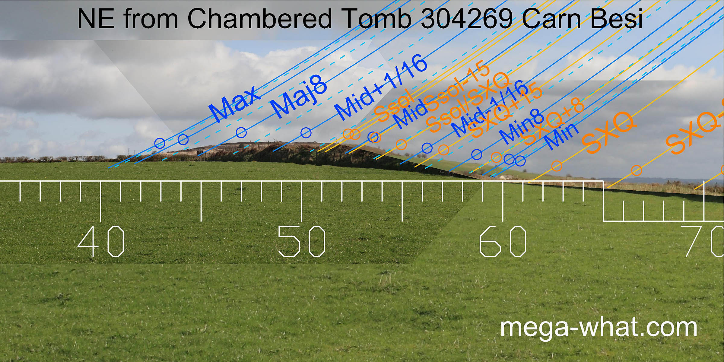 The north-eastern lunisticeLunistices are the most northerly and southerly moons of the month. The lunar equivalent of solstices - more.
range falls across a hilltop with the major standstillLunistice positions vary cyclically over an 18.6 year period but are fairly static for more than a year at either end of the range
occurring at the intersect with local ground.
It looks as though the other end of the range starts with the cross-quarter at the foot of the slope but only the major end has been accurately surveyed because the remainder is obscured.
The north-eastern lunisticeLunistices are the most northerly and southerly moons of the month. The lunar equivalent of solstices - more.
range falls across a hilltop with the major standstillLunistice positions vary cyclically over an 18.6 year period but are fairly static for more than a year at either end of the range
occurring at the intersect with local ground.
It looks as though the other end of the range starts with the cross-quarter at the foot of the slope but only the major end has been accurately surveyed because the remainder is obscured.
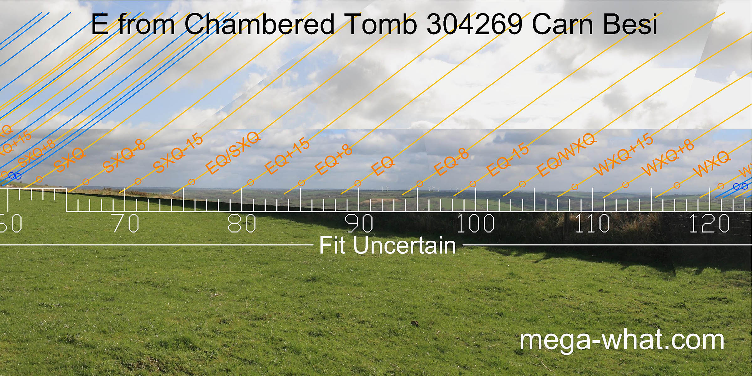 Almost the entire eastern horizon is hidden behind a field boundary but it is low and distant.
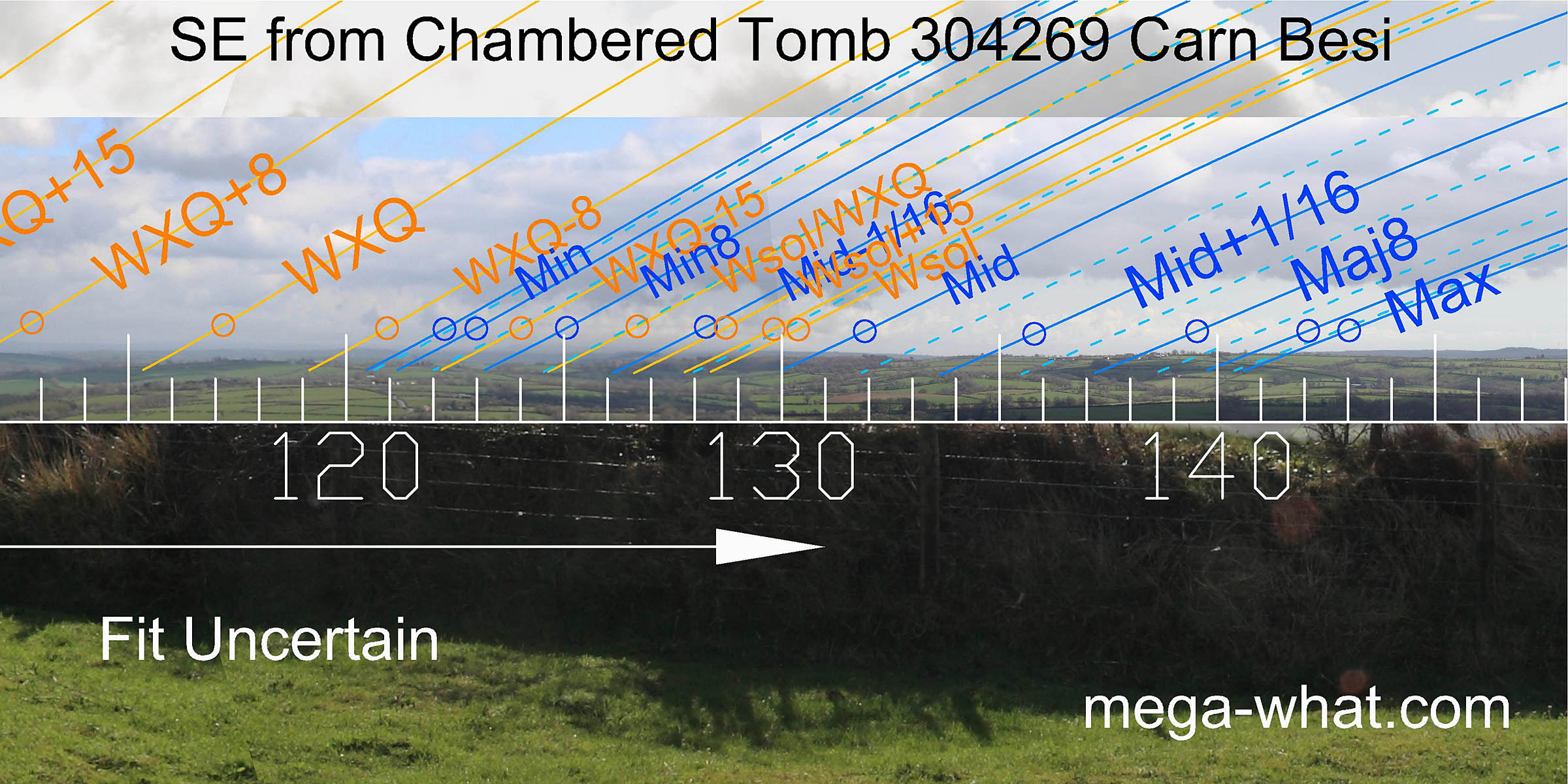 To the south-east, only the major end of the lunisticeLunistices are the most northerly and southerly moons of the month. The lunar equivalent of solstices - more.
range could be accurately surveyed. The remainder was either obscured or too hazy.
To the south-east, only the major end of the lunisticeLunistices are the most northerly and southerly moons of the month. The lunar equivalent of solstices - more.
range could be accurately surveyed. The remainder was either obscured or too hazy.
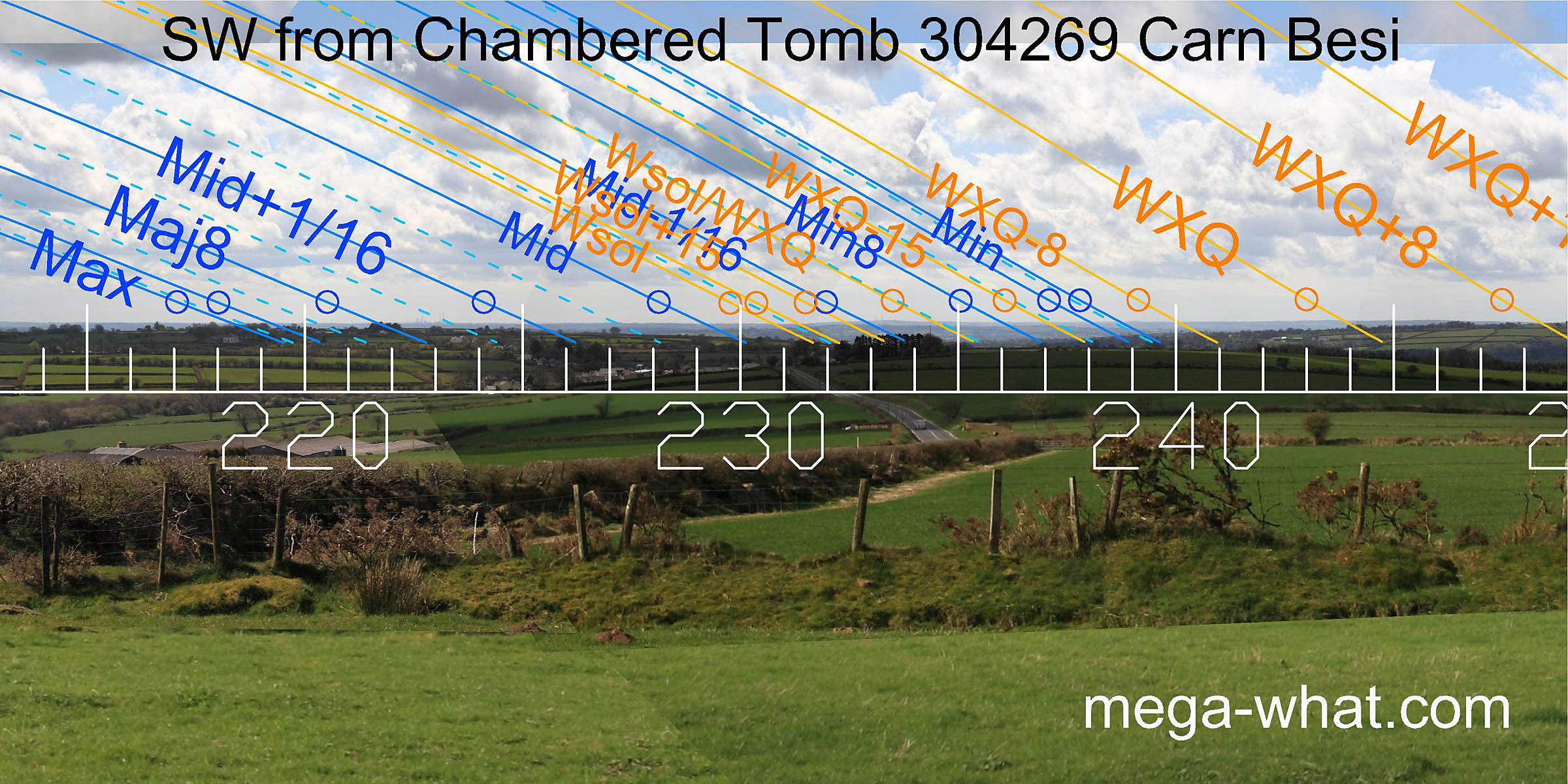 South-westwards, a distant hazy horizon is just visible above nearer ground.
The major eighth is at a local high point and, were this nearer ground covered with trees,
then the major standstillLunistice positions vary cyclically over an 18.6 year period but are fairly static for more than a year at either end of the range
and the winter cross-quarters would be at intersections of the near and far horizons.
South-westwards, a distant hazy horizon is just visible above nearer ground.
The major eighth is at a local high point and, were this nearer ground covered with trees,
then the major standstillLunistice positions vary cyclically over an 18.6 year period but are fairly static for more than a year at either end of the range
and the winter cross-quarters would be at intersections of the near and far horizons.
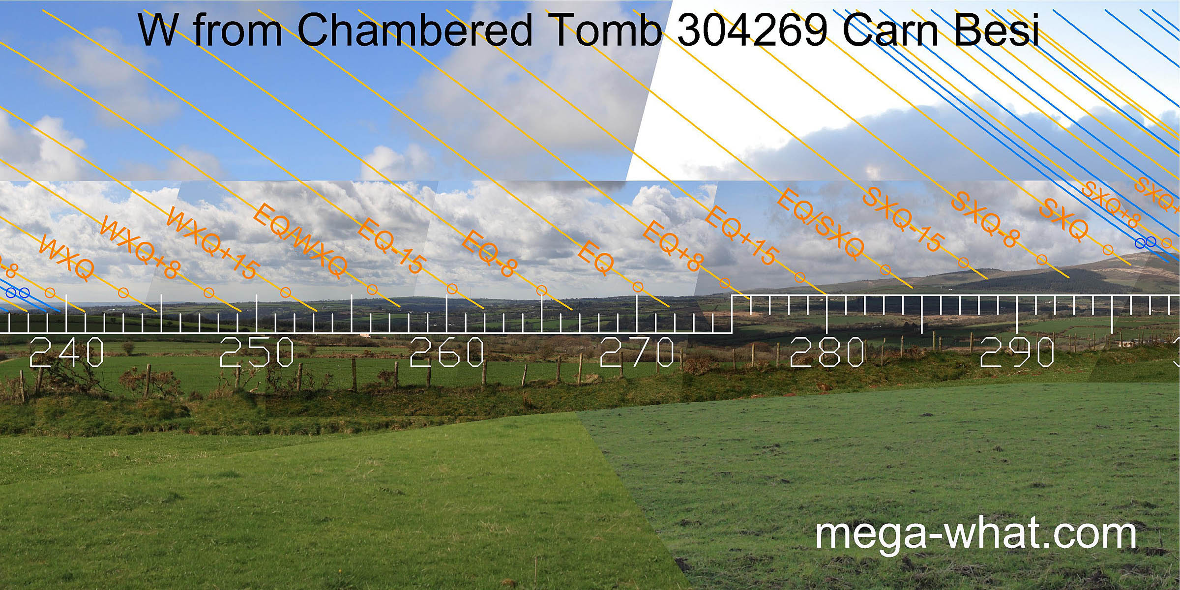 To the west, most notably, the equinox is on a hilltop and the quarter-month south of it is at the bottom of a major dip.
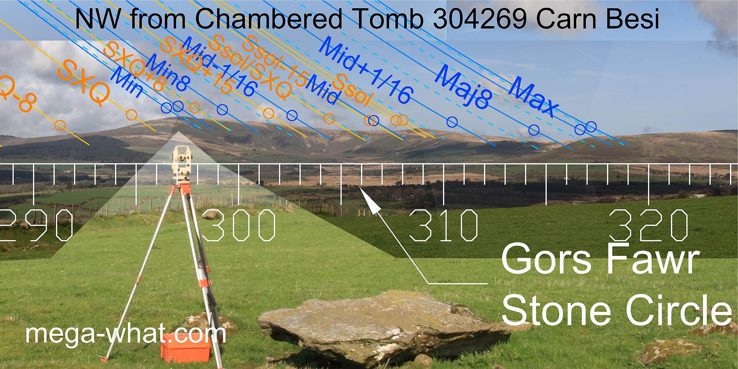 The north-western quadrant is clearly the major focus here.
Foel Cwmcerwyn, the highest of the Preseli mountains, marks the minor standstillLunistice positions vary cyclically over an 18.6 year period but are fairly static for more than a year at either end of the range
of the moon and summer solstice sunset is on the next peak.
The north-western quadrant is clearly the major focus here.
Foel Cwmcerwyn, the highest of the Preseli mountains, marks the minor standstillLunistice positions vary cyclically over an 18.6 year period but are fairly static for more than a year at either end of the range
of the moon and summer solstice sunset is on the next peak.
Being situated close to the ridge crest, Carn Besi would have been visible on the south-east horizon from Gors Fawr Stone Circle.
There are many prehistoric tombs in the U.K. but the only other surveyed ones are:
- Bryn Celli Ddu Chambered Tomb on Anglesey.
- Stoney Littleton Long Barrow in Somerset.
- West Kennet Long Barrow in Wiltshire.
References
- National Monuments Record of Wales: Coflein database - site details.
- FIGGIS, N.P. 2001 Prehistoric Preseli a field guide. Machynlleth: Atelier Productions. p77, no.17.