
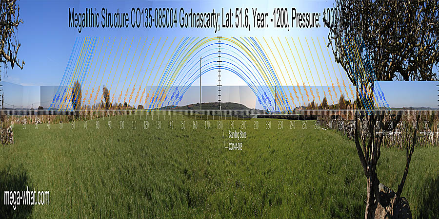
 Gortnascarty Megalithic Structure is about 3km south-west of Clonakilty, beside the graveyard of a ruined church.
Not classified as one but certainly a Boulder-Burial type of monument. No visible supports but otherwise looks not untypical, except for the axis which is NW/SE rather than NE/SW.
Gortnascarty Megalithic Structure is about 3km south-west of Clonakilty, beside the graveyard of a ruined church.
Not classified as one but certainly a Boulder-Burial type of monument. No visible supports but otherwise looks not untypical, except for the axis which is NW/SE rather than NE/SW.
South is on Corrabally hilltop [Pic] where Possible Standing Stone CO144-008, recorded on the 1902 OS map, might once have been visibly significant but it is now gone. North is on a fairly level horizon but there are hills to both sides and it is low in the middle [Pic].
![[Pic]](Gortnascarty-S.jpg)
![[Pic].](Gortnascarty-N.jpg)
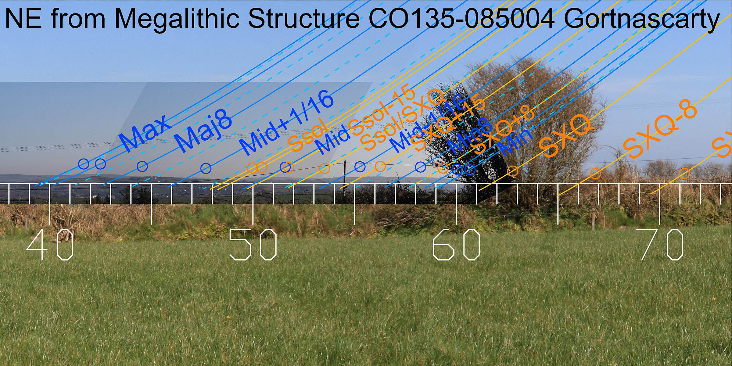 To the north-east, somewhere behind the bushes is the intersection of distant and local horizons.
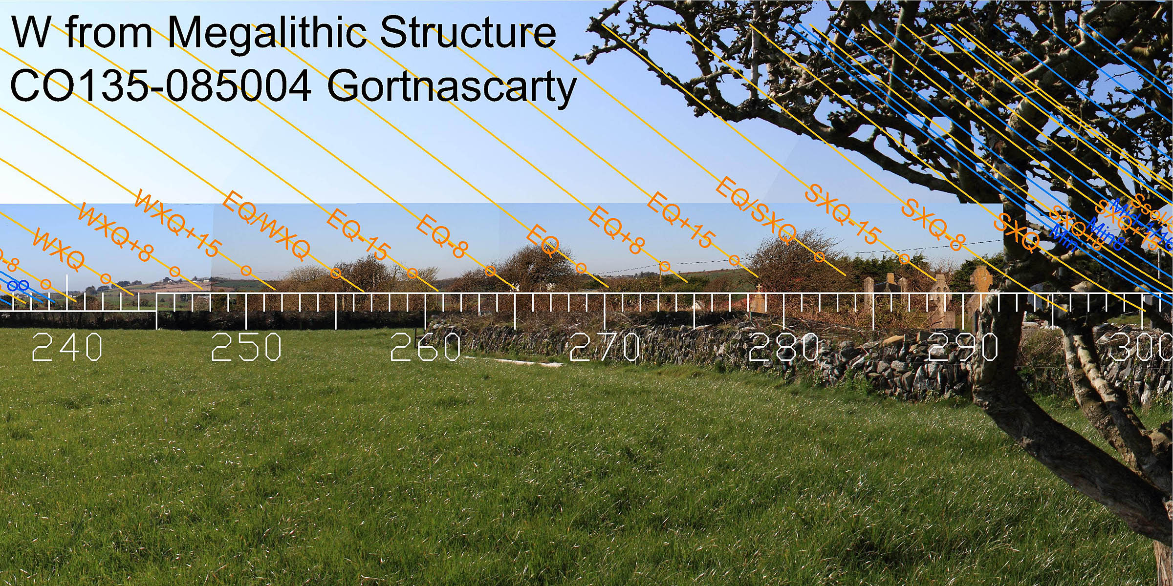
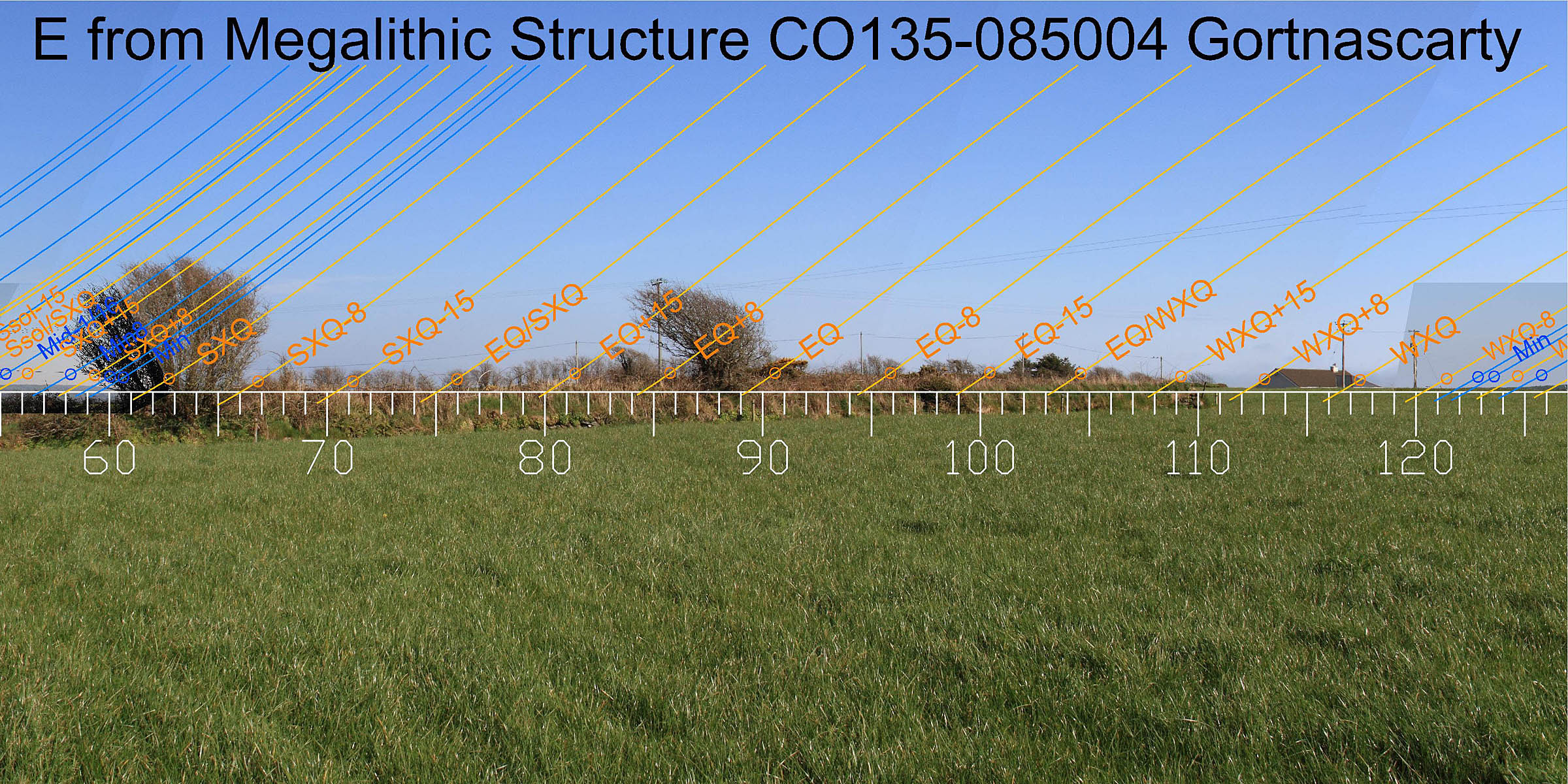 Eastwards the equinoctial zone is on local ground but the exact whereabouts of the top of the rise is concealed by roadside banks.
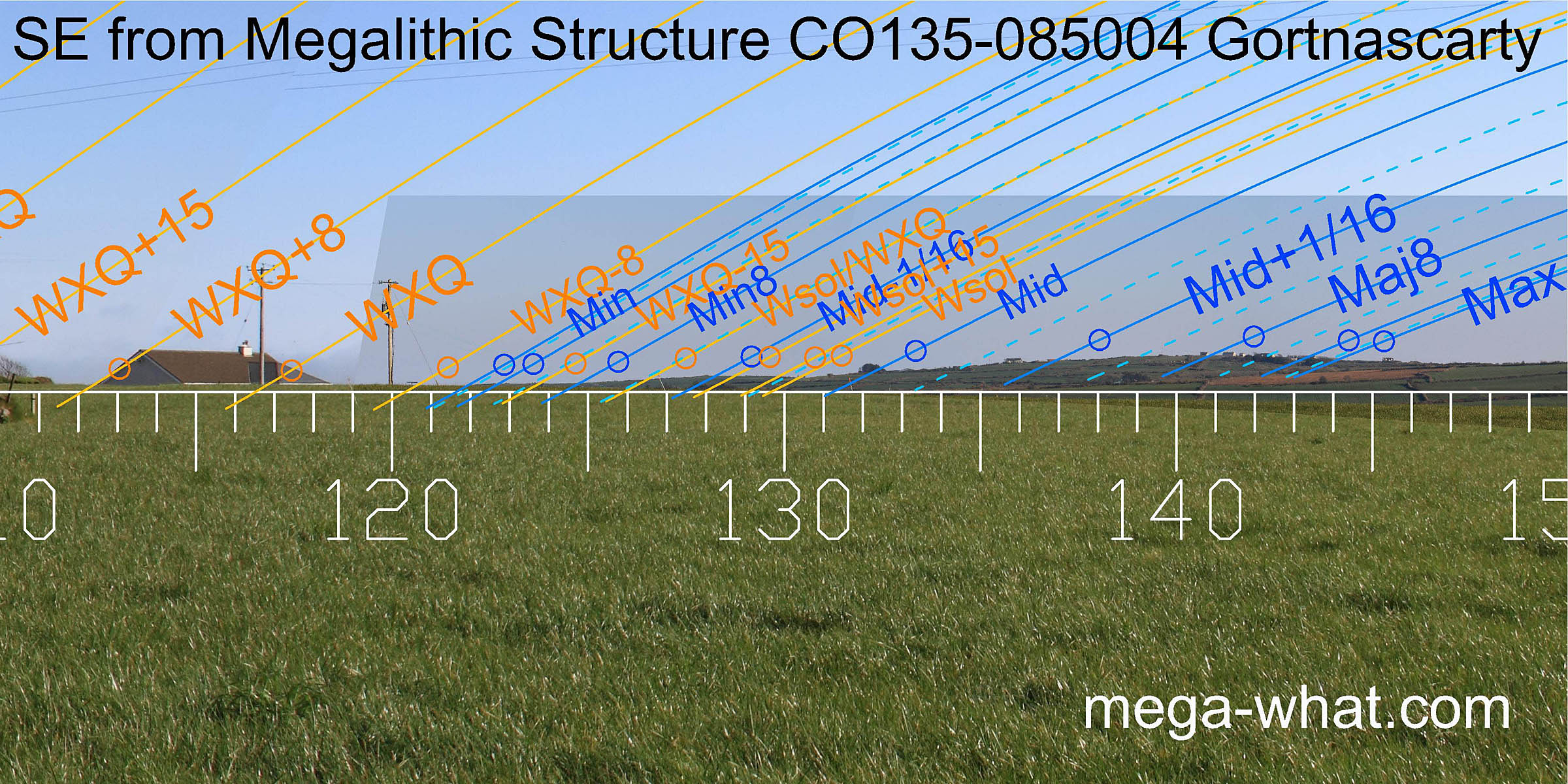 South-east, the intersect of local with further horizons is a quarter-month south of the cross-quarter.
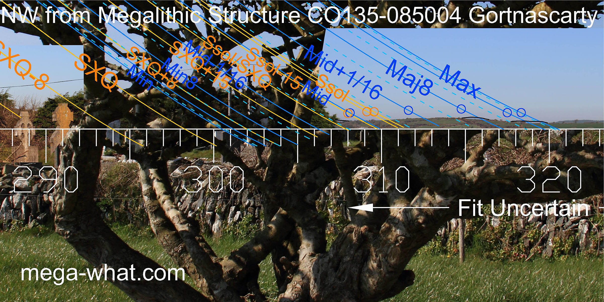
The minor standstillLunistice positions vary cyclically over an 18.6 year period but are fairly static for more than a year at either end of the range
is at the end of the further ridge and then the first highpoint is a sixteenth from it.
After a slight drop and a further rise, the next top is the sixteenth before the lunar midpoint.
The next dip is the winter solstice and the main hilltop the major eighth, with a slight break in the south slope marking the major
standstillLunistice positions vary cyclically over an 18.6 year period but are fairly static for more than a year at either end of the range.
South-east, the intersect of local with further horizons is a quarter-month south of the cross-quarter.
The minor standstillLunistice positions vary cyclically over an 18.6 year period but are fairly static for more than a year at either end of the range
is at the end of the further ridge and then the first highpoint is a sixteenth from it.
After a slight drop and a further rise, the next top is the sixteenth before the lunar midpoint.
The next dip is the winter solstice and the main hilltop the major eighth, with a slight break in the south slope marking the major
standstillLunistice positions vary cyclically over an 18.6 year period but are fairly static for more than a year at either end of the range.
In this direction, the monument axis is towards mid+1/16 [Pic].
![[Pic]](Gortnascarty-SEax.jpg)
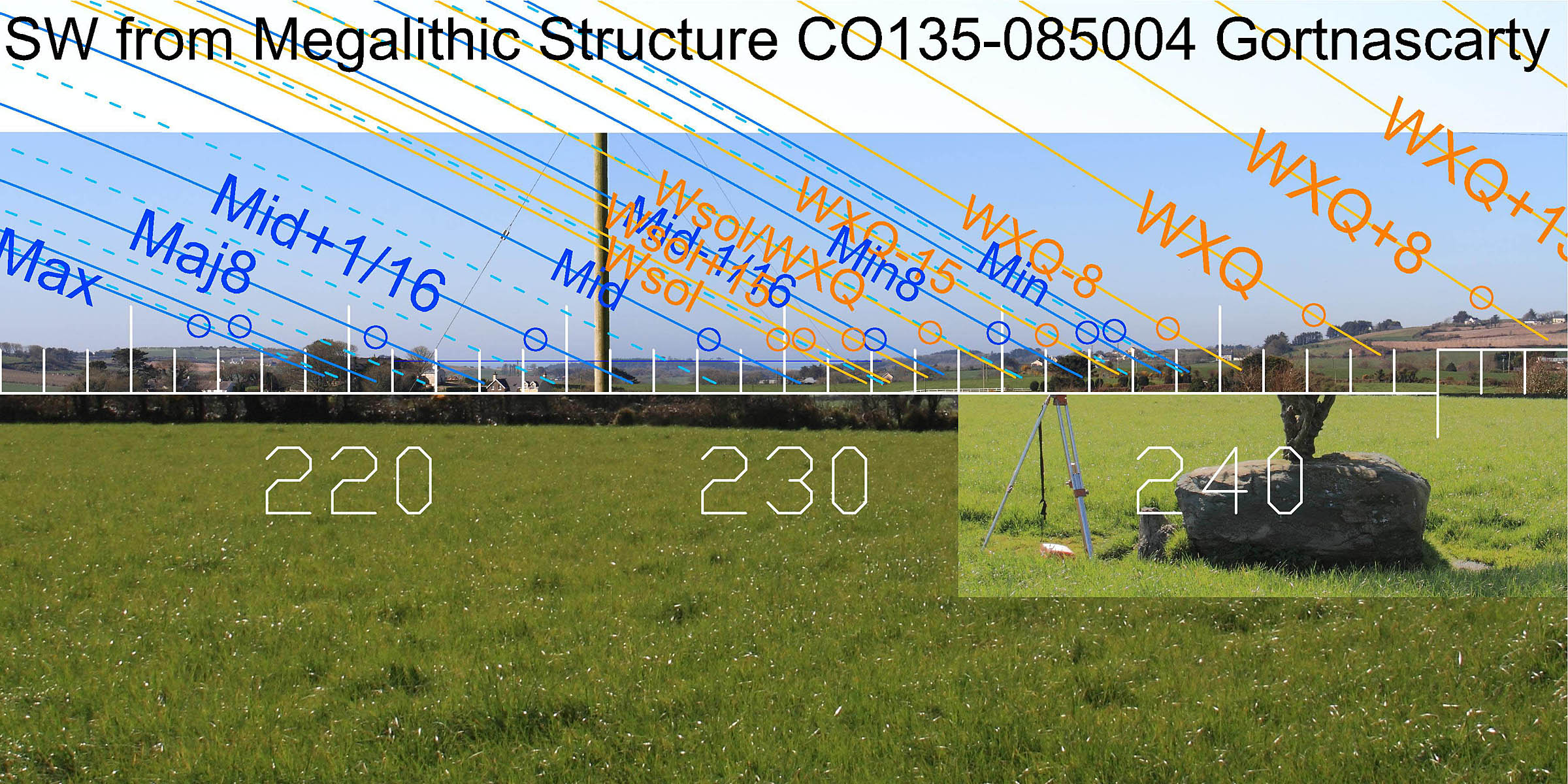 To the south-west the major lunar limit is on a low hilltop, then there are two small bays.
The sides of the first mark a lunar eighth and a sixteenth. The sides of the second mark the lunar midpoint and the winter solstice.
To the south-west the major lunar limit is on a low hilltop, then there are two small bays.
The sides of the first mark a lunar eighth and a sixteenth. The sides of the second mark the lunar midpoint and the winter solstice.
 The west is largely obscured but the slope up from the coastal plain spans a half-month around the winter cross-quarter. Beyond that a long slope leads up to a hilltop.
The bottom of the slope is halfway between equinox and winter cross-quarters, the hilltop halfway between equinox and summer cross-quarters.
The equinox itself seems to be at something of a break in the middle.
The west is largely obscured but the slope up from the coastal plain spans a half-month around the winter cross-quarter. Beyond that a long slope leads up to a hilltop.
The bottom of the slope is halfway between equinox and winter cross-quarters, the hilltop halfway between equinox and summer cross-quarters.
The equinox itself seems to be at something of a break in the middle.
 The north-west is largely obscured by an evergreen hedge, a ruined church and a graveyard, as well as the whitethorn.
The high, wide end of the Boulder-Burial indicates this direction and its axis is towards major standstillLunistice positions vary cyclically over an 18.6 year period but are fairly static for more than a year at either end of the range of the moon. Two small upright stones effectively square off the slanting concavity of the boulder's lower, south-east end [Pic].
![[Pic]](Gortnascarty-NWax.jpg)
Coorleigh South, 1.2km to the south-west, is another boulder-burial-like site. The only other known megalithic sites in this area are two Standing Stones recorded by the Ordnance Survey but both now gone. It seems likely that all four sites are related and were possibly all built by the same people.
The nearest official boulder-burial is 4.3km to the north-north-west at Ballyvackey.
References
- Archaeological Survey of Ireland, record details. www.archaeology.ie/archaeological-survey-ireland
- POWER, D. et al. 1992 Archaeological Inventory of County Cork, Volume 1: West Cork. Dublin: Stationary Office. p114, no.934.