
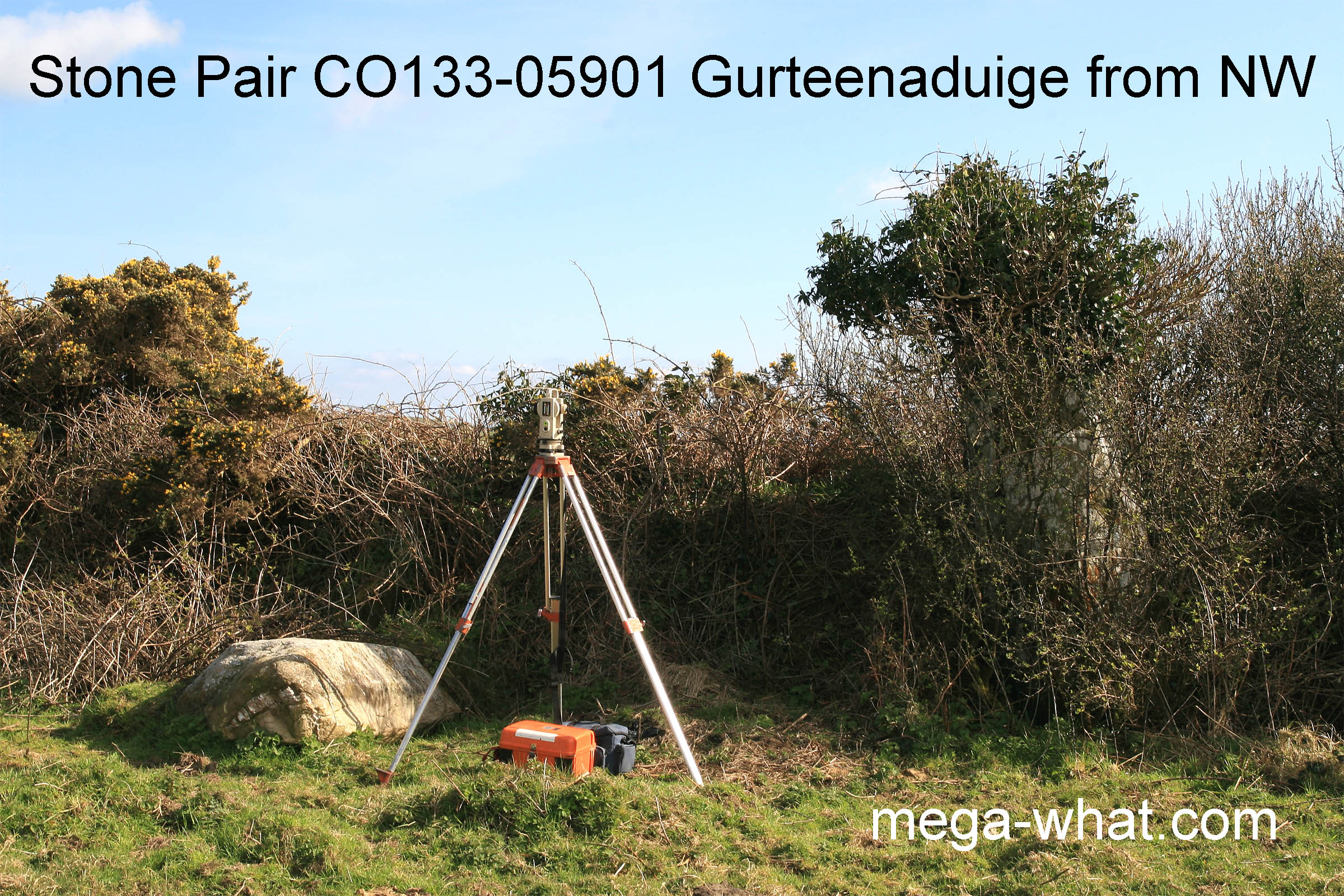
 Gurteenaduige Standing Stone Pair is a couple of kilometres north of Leap.
Survey was impeded because the position in a field fence near an overgrown field corner means that sightlines are restricted.
The taller, south-west stone is surrounded by blackthorn and crowned with ivy, the north-east stone has fallen. The axis of the pair is therefore uncertain but was probably similar to that of the hedge.
 South is on a hilltop within a dip [Pic].
![[Pic].](Gurteenaduige-S.jpg)
North is at the foot of a hill, at the right side of a dip [Pic].
![[Pic].](Gurteenaduige-N.jpg)
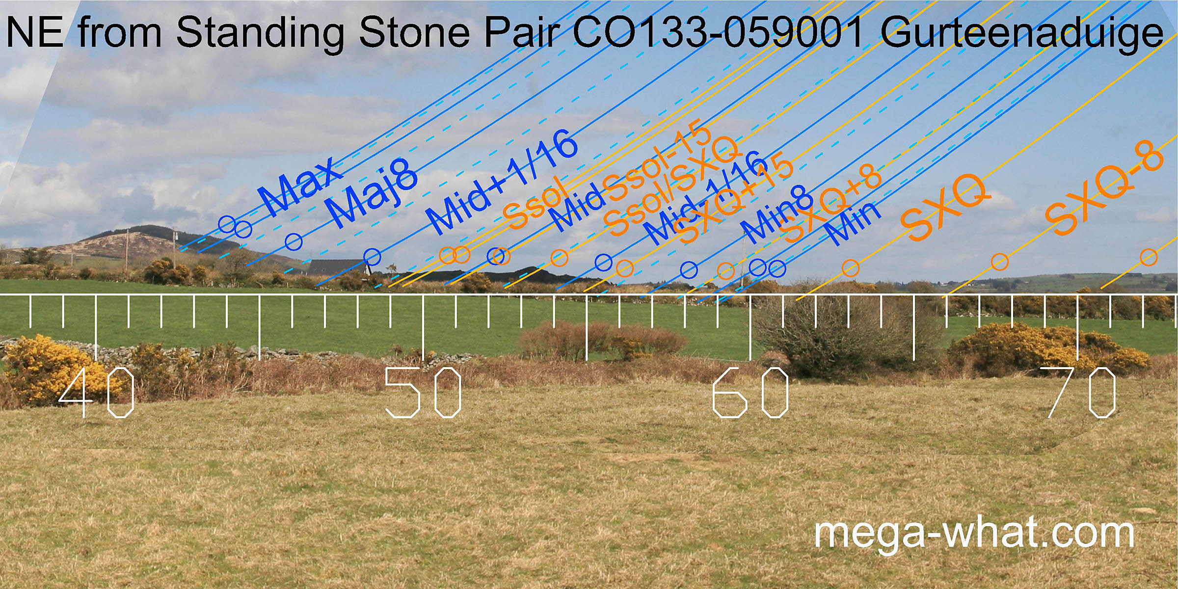 To the north-east Carrig Fadda has a small secondary summit, now surmounted by a cross.
The major standstillLunistice positions vary cyclically over an 18.6 year period but are fairly static for more than a year at either end of the range
would have been about a diameter south of this, more or less at the step visible in the photo.
The sixteenth north of the lunar midpoint looks to have been at the foot of the hill but that area is now concealed by a house.
To the north-east Carrig Fadda has a small secondary summit, now surmounted by a cross.
The major standstillLunistice positions vary cyclically over an 18.6 year period but are fairly static for more than a year at either end of the range
would have been about a diameter south of this, more or less at the step visible in the photo.
The sixteenth north of the lunar midpoint looks to have been at the foot of the hill but that area is now concealed by a house.
Further south are a set of good markers for the period north of the summer cross-quarters.
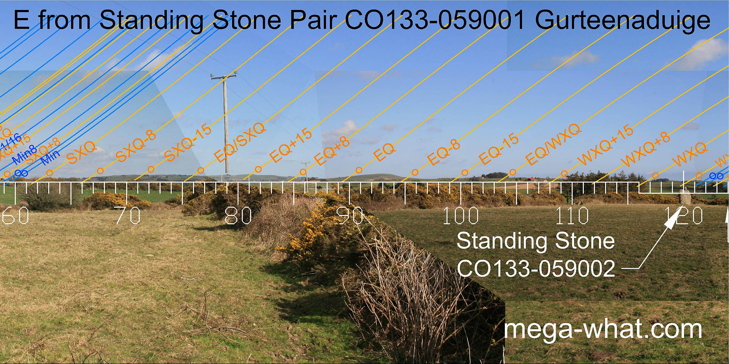 Eastwards there are a collection of good markers around the equinox which itself falls in the middle of the north slope of a hill, the top and bottom of which are three days either side of it.
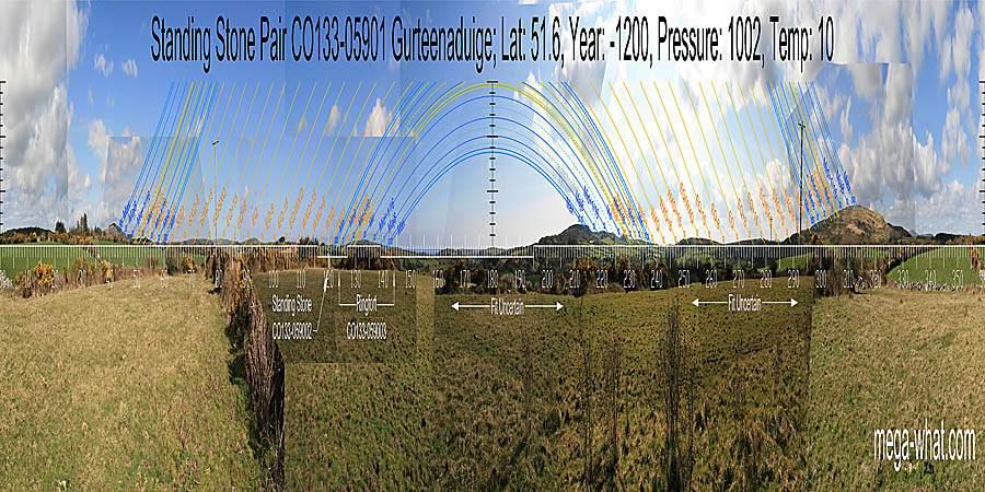
The monument axis would likely have been somewhat similar to the hedge line.
Eastwards there are a collection of good markers around the equinox which itself falls in the middle of the north slope of a hill, the top and bottom of which are three days either side of it.
The monument axis would likely have been somewhat similar to the hedge line.
About 150m away to the south-east is Standing Stone CO133-059002. It is instructive to compare the two sites.
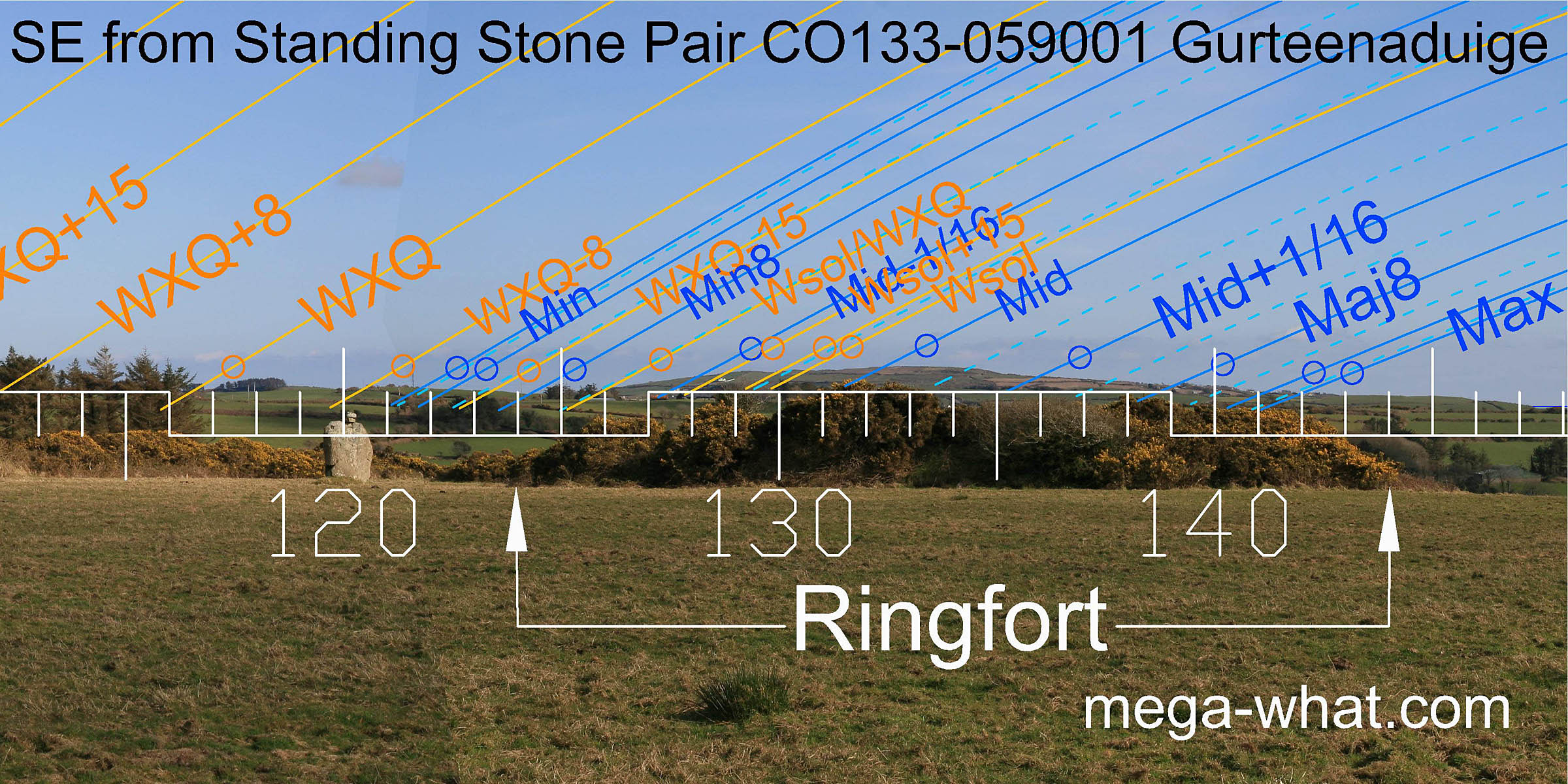 When viewed from the correct position close to the stones of the pair, the Standing Stone is under the low hill which marks the minor end of the lunisticeLunistices are the most northerly and southerly moons of the month. The lunar equivalent of solstices - more.
range.
The north foot of this hill is a quarter-month from the cross-quarters while its southern foot is a diameter beyond the cross-quarter's half-month bracket but accurate for the lunar minor eighth.
When viewed from the correct position close to the stones of the pair, the Standing Stone is under the low hill which marks the minor end of the lunisticeLunistices are the most northerly and southerly moons of the month. The lunar equivalent of solstices - more.
range.
The north foot of this hill is a quarter-month from the cross-quarters while its southern foot is a diameter beyond the cross-quarter's half-month bracket but accurate for the lunar minor eighth.
The next hill has the lunar midpoint on its top and the major end of the cycle at its southern foot. Its subsidiary top and the dip to the south of that usefully indicate the winter solstice and the month surrounding it.
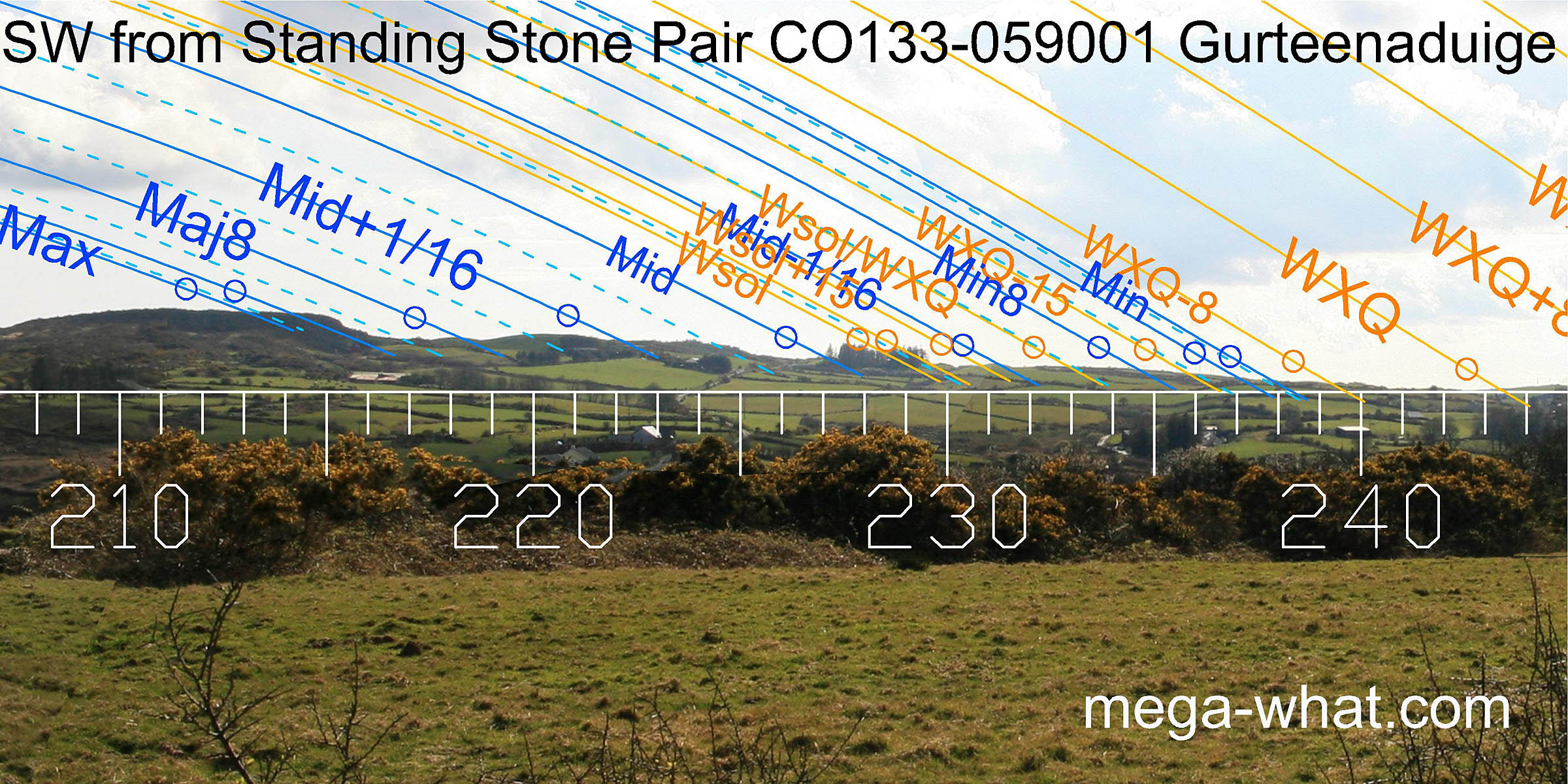 To the south-west, the lunar limit is on a hilltop with the winter cross-quarter in its northern basal dip. The slopes between them undulate sufficiently to be quite useful.
 This is the view from the other side of the western hedge. In the approximate south-west axial direction, above Ballin Lough, is a small hill in a dip between two other hills.
The winter cross-quarters are at its southern base with a quarter-month just above the northern intersect. North of that is a useful looking section that could not be surveyed from the pair.
This is the view from the other side of the western hedge. In the approximate south-west axial direction, above Ballin Lough, is a small hill in a dip between two other hills.
The winter cross-quarters are at its southern base with a quarter-month just above the northern intersect. North of that is a useful looking section that could not be surveyed from the pair.
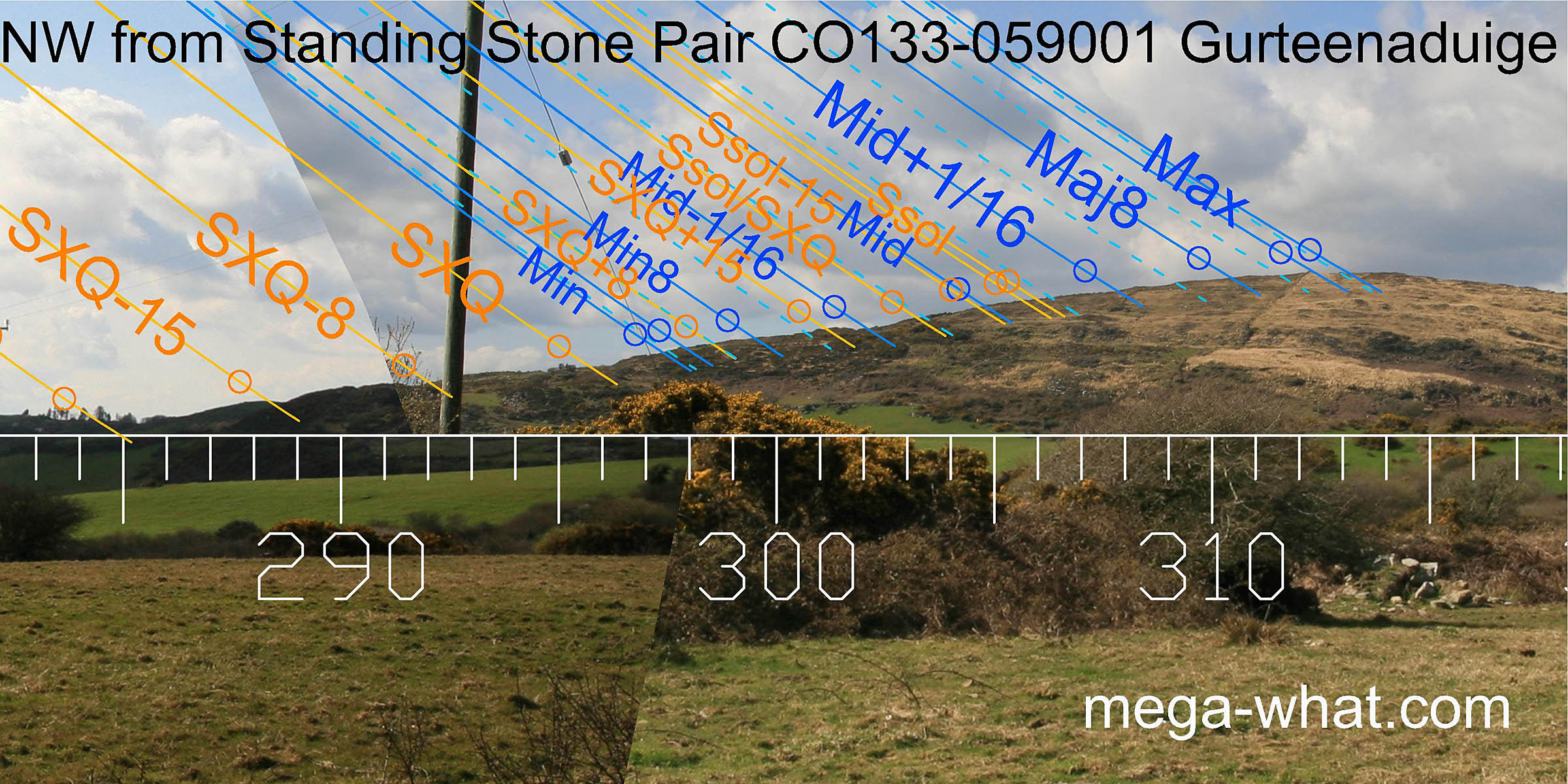 The north-western hill has the lunar limit on its summit.
An obvious notch on the slope is accurate for the moon at a sixteenth on the minor side of the midpoint, with the half-month bracket for the cross-quarter just before it.
The cross-quarters occur at the next notch/step to the south and further notches in this slope are also useful.
The north-western hill has the lunar limit on its summit.
An obvious notch on the slope is accurate for the moon at a sixteenth on the minor side of the midpoint, with the half-month bracket for the cross-quarter just before it.
The cross-quarters occur at the next notch/step to the south and further notches in this slope are also useful.
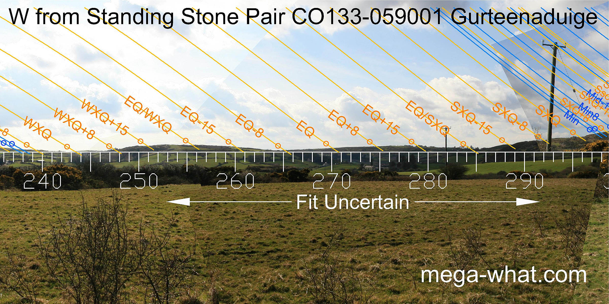
Note that while all survey was from the position of the pair, the photos used in the panorama are not. The north-west and north-east were shot from the pair, the south-east from the other side of the adjacent hedge and the south-west from the other side of the nearby western hedge.
This Stone Pair is not far from the coast but it is isolated from others of its kind:
Kilmore Stone Pair is 9.1km to the north-west, Sarue Stone Pair is 8.6km east-north-east but unsurveyed.
Nearby are Boulder-Burials at Ballyroe (unsurveyed) and Keamore.
References
- Archaeological Survey of Ireland, record details. www.archaeology.ie/archaeological-survey-ireland
- Ó'NUALLÁIN, SEÁN 1988 Stone Rows in the South of Ireland. Proceedings of the Royal Irish Academy 88c:179-256, p253, no.179.
- POWER, D. et al. 1992 Archaeological Inventory of County Cork, Volume 1: West Cork. Dublin: Stationary Office. p41, no.188.