
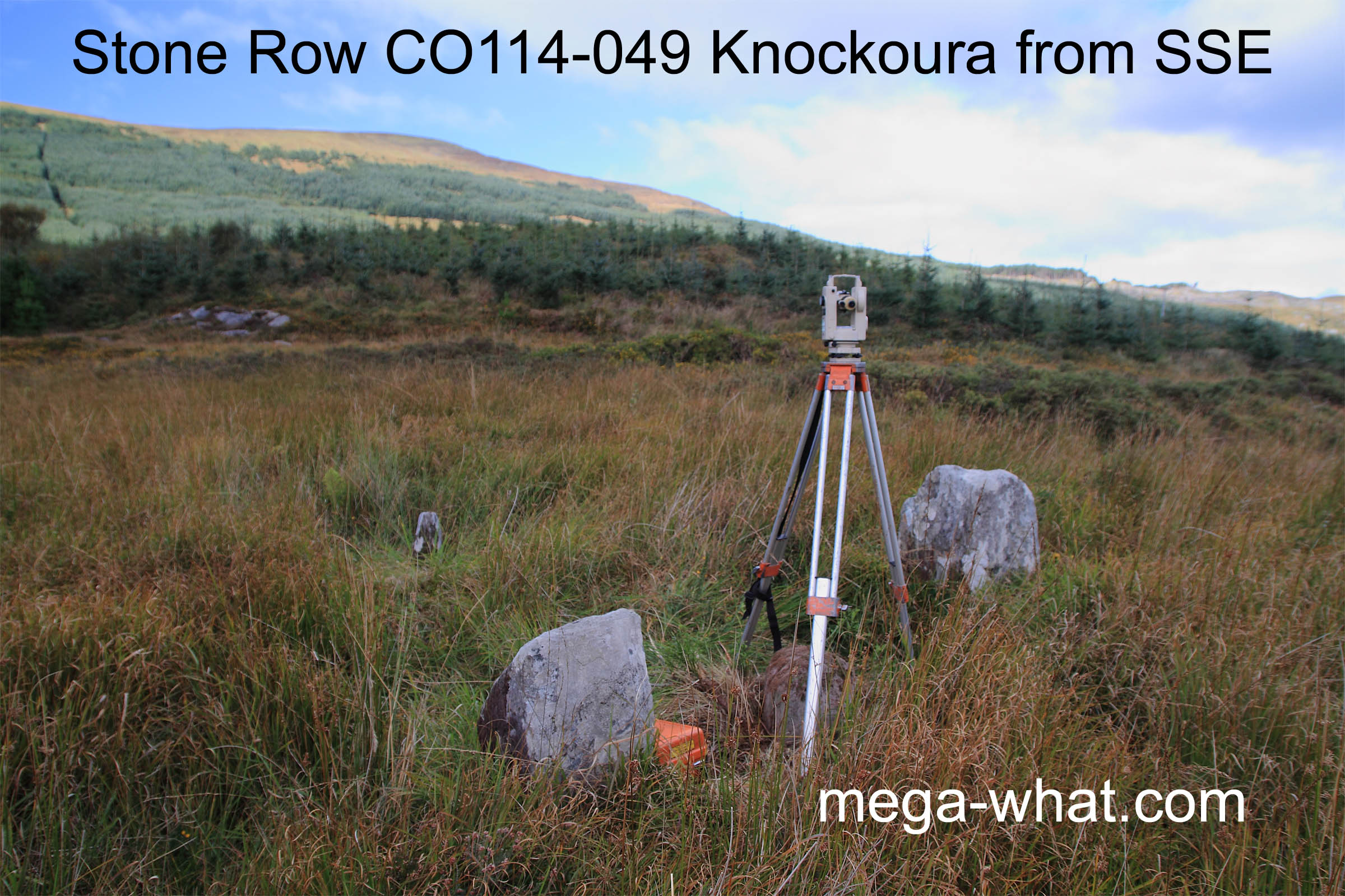
 Knockoura Stone Row is in a forestry plantation but close to the road, about 5km or so from both Castletown and Allihies, as the crow flies.
Three small stones are set fairly close together - overall length c.3.25m, tallest stone 0.9m high. Then there is a fourth slab, c.2.5m west of the middle stone, which adds extra interest because it is there to be investigated. There may once have been a similar fourth stone at Cullenagh but that one is long gone.
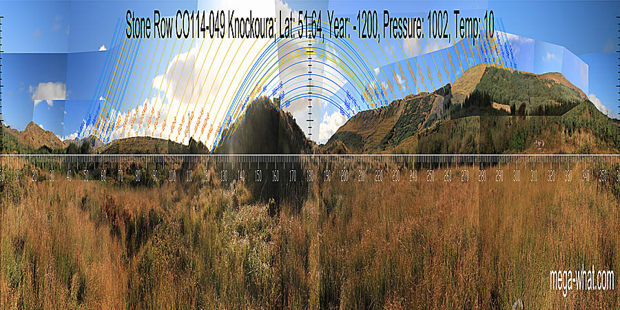 The view combines local and nearby ground with more distant hills.
South is at a break in the left slope of a dip [Pic].
![[Pic].](Knockoura-S.jpg)
North is at a break in the left slope of a dip [Pic].
![[Pic].](Knockoura-N.jpg)
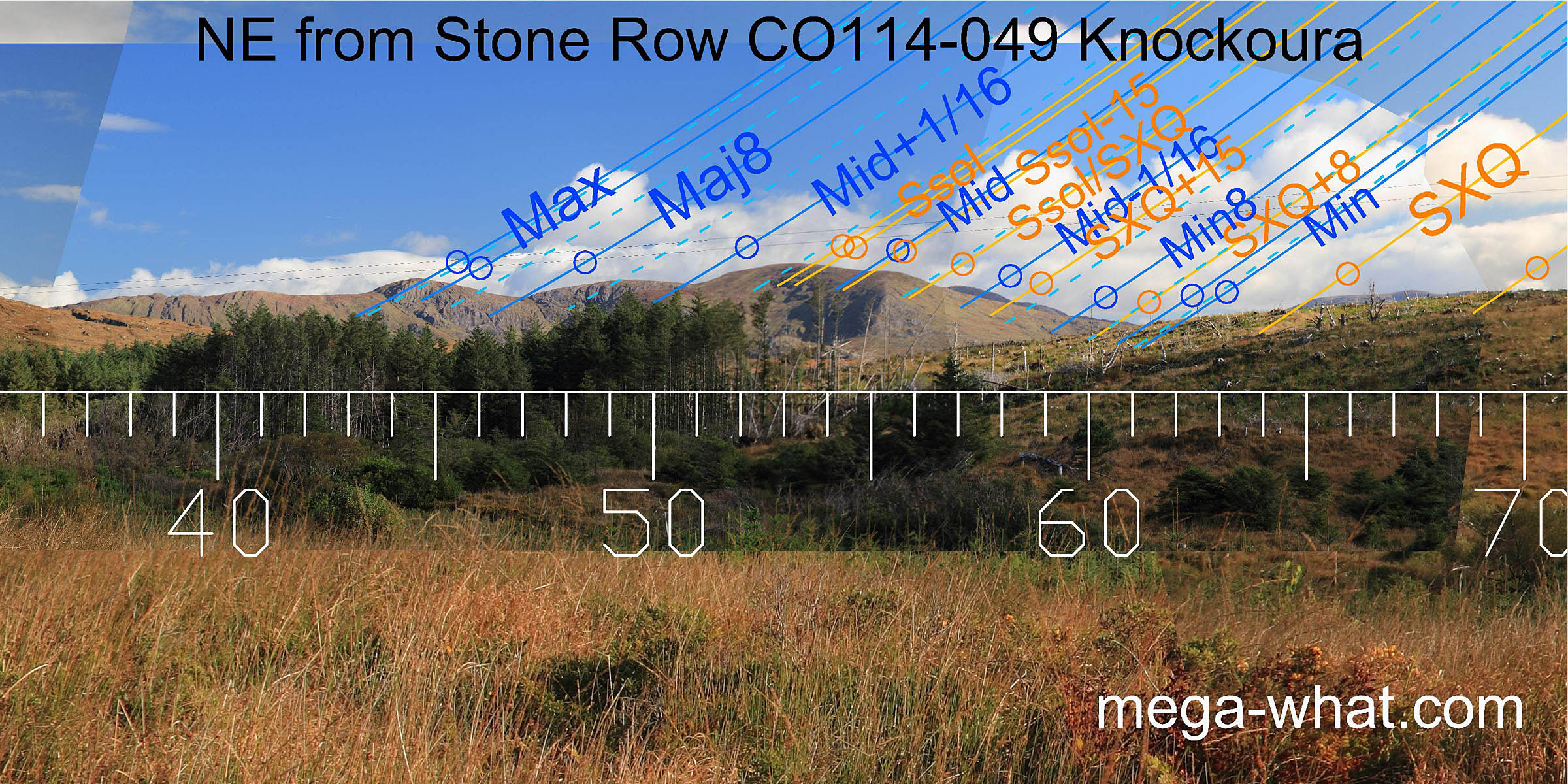 The north-eastern lunisticeLunistices are the most northerly and southerly moons of the month. The lunar equivalent of solstices - more.
range runs mostly over distant hills but more local intersects also provide useful markers.
Both solstice and major standstillLunistice positions vary cyclically over an 18.6 year period but are fairly static for more than a year at either end of the range
are on hilltops.
The north-eastern lunisticeLunistices are the most northerly and southerly moons of the month. The lunar equivalent of solstices - more.
range runs mostly over distant hills but more local intersects also provide useful markers.
Both solstice and major standstillLunistice positions vary cyclically over an 18.6 year period but are fairly static for more than a year at either end of the range
are on hilltops.
The axes of the row and of its individual stones are well beyond major standstillLunistice positions vary cyclically over an 18.6 year period but are fairly static for more than a year at either end of the range in this direction [See Axial Pics].
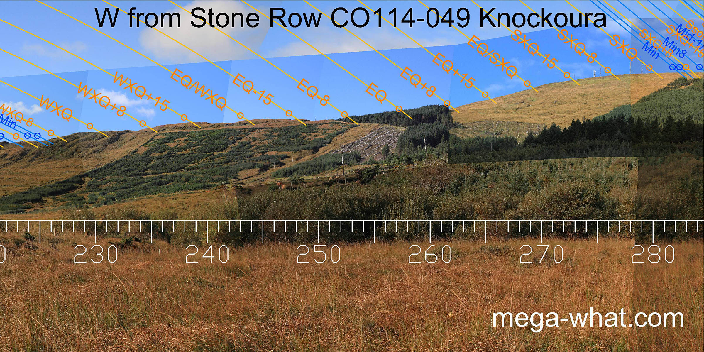
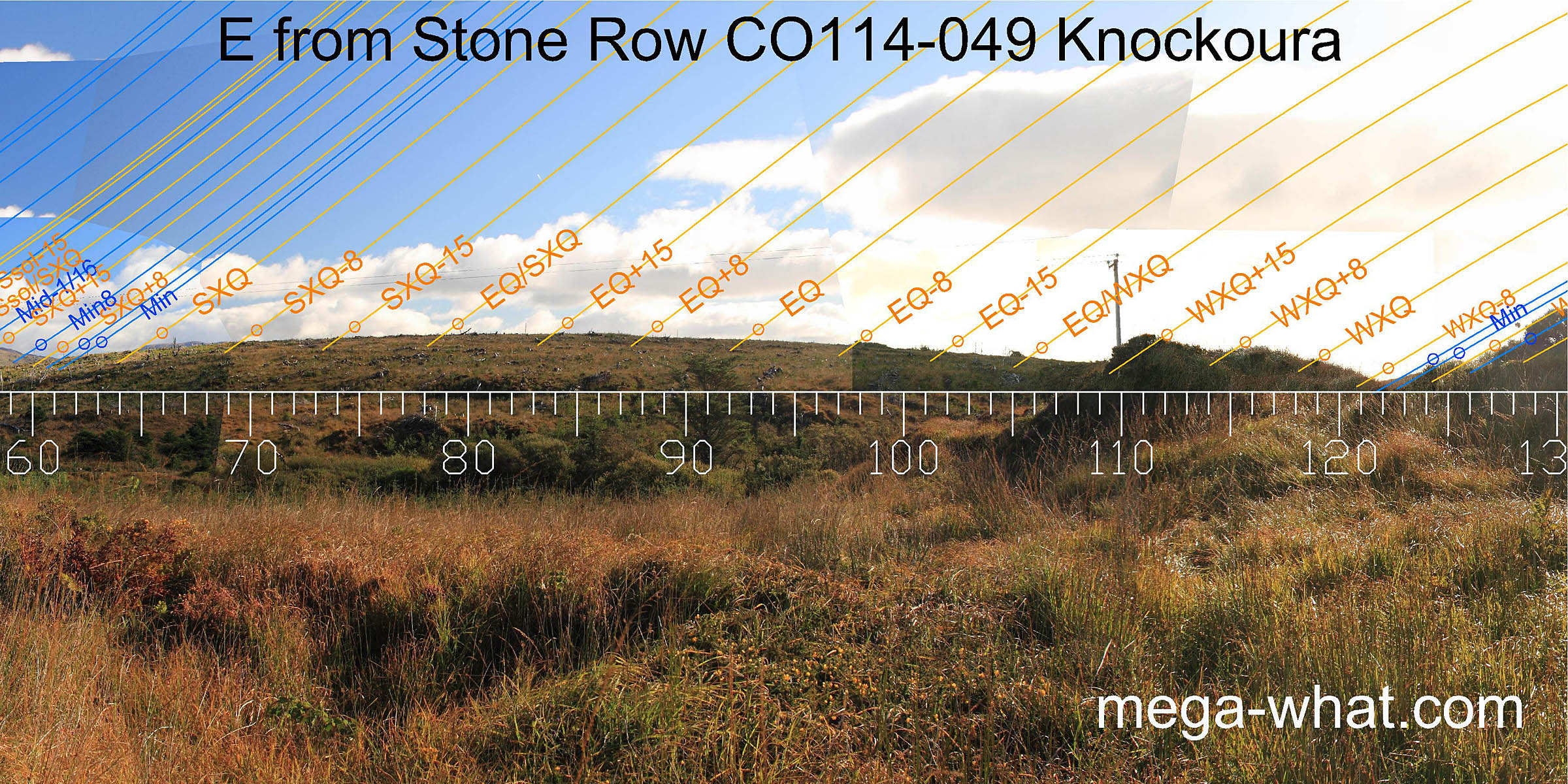 Eastwards is a local low hilltop. Critical markers there are SXQ-8 at an intersect and EQ+8 at a step.
They delimit the month centred on the equinox / summer cross-quarter midpoint. The hump at EQ-8 is a pile of logs.
Eastwards is a local low hilltop. Critical markers there are SXQ-8 at an intersect and EQ+8 at a step.
They delimit the month centred on the equinox / summer cross-quarter midpoint. The hump at EQ-8 is a pile of logs.
A very local hump spans a half-month or so north of the winter cross-quarters which are themselves indicated by a line from the fourth stone through the centre stone [Pic].
![[Pic]](Knockoura-SEax.jpg)
 To the south-east a short stretch of distant horizon is visible through a gap between two local humps.
It is clearly very position sensitive, marking minor standstillLunistice positions vary cyclically over an 18.6 year period but are fairly static for more than a year at either end of the range
in this view from over the central stone.
To the south-east a short stretch of distant horizon is visible through a gap between two local humps.
It is clearly very position sensitive, marking minor standstillLunistice positions vary cyclically over an 18.6 year period but are fairly static for more than a year at either end of the range
in this view from over the central stone.
The remainder of the lunisticeLunistices are the most northerly and southerly moons of the month. The lunar equivalent of solstices - more. range runs up and over the hump which would have been kept clear of vegetation. The axis of the fourth stone indicates the centre of the major half of the lunisticeLunistices are the most northerly and southerly moons of the month. The lunar equivalent of solstices - more. range [Pic].
![[Pic]](Knockoura-SEax2.jpg)
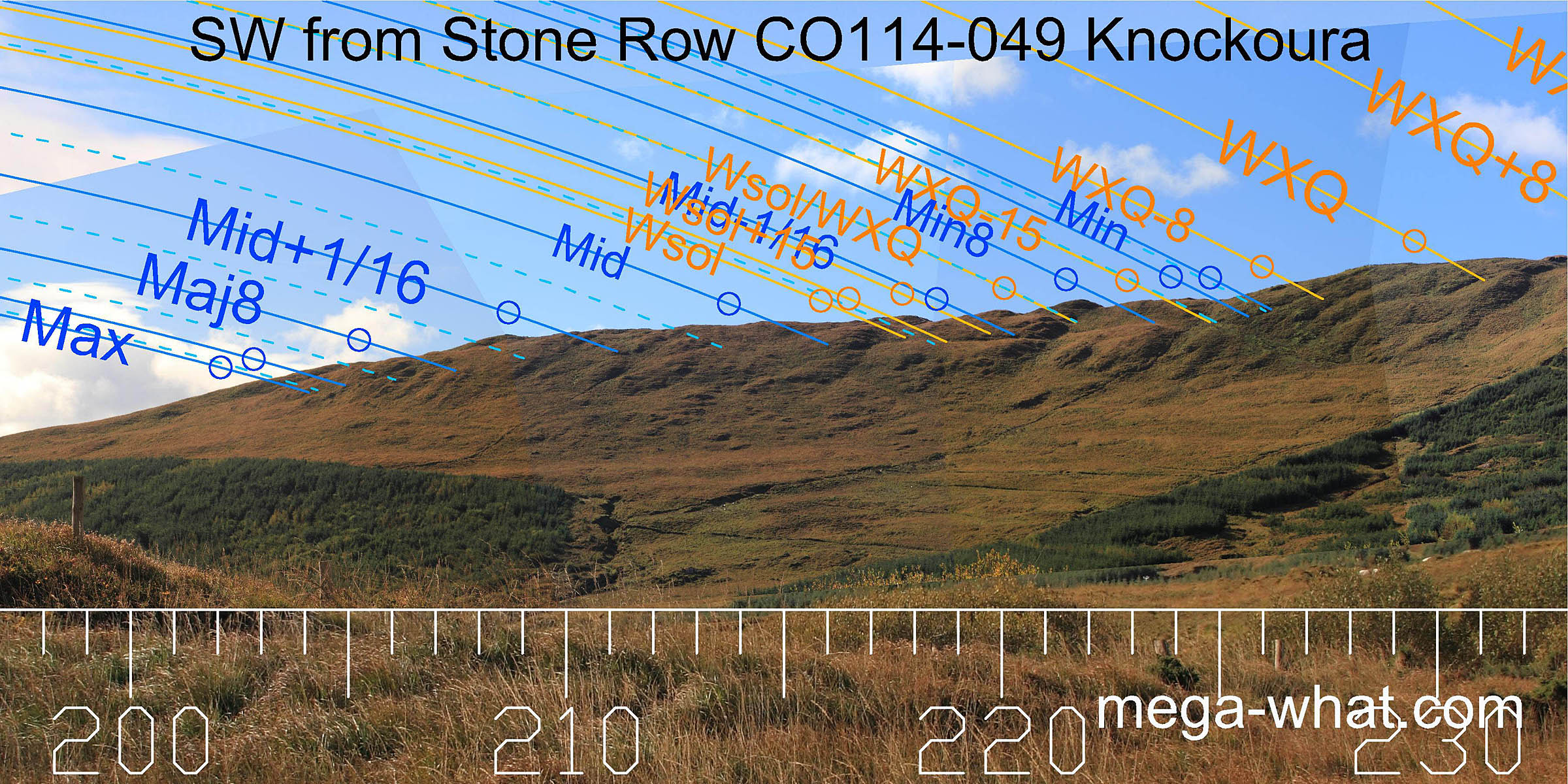 The south-western lunisticeLunistices are the most northerly and southerly moons of the month. The lunar equivalent of solstices - more.
range runs along the end of a ridge.
Winter solstice is at the south end of a humpy bumpy section and winter cross-quarters are in a dip of the first significant top.
The south-western lunisticeLunistices are the most northerly and southerly moons of the month. The lunar equivalent of solstices - more.
range runs along the end of a ridge.
Winter solstice is at the south end of a humpy bumpy section and winter cross-quarters are in a dip of the first significant top.
The row axis is well beyond major standstillLunistice positions vary cyclically over an 18.6 year period but are fairly static for more than a year at either end of the range , unless the ridge was still fully forested. The end stones of the row have less extreme axes however and do indicate lunar events. [See Axial Pics]
 Winter cross-quarters are in a dip of the first significant top and summer cross-quarters are at the top of the slope / the left end of the north-western hilltop.
Between them the equinox is at the foot of the steep slope, probably at a dip or step but now concealed by forestry.
Winter cross-quarters are in a dip of the first significant top and summer cross-quarters are at the top of the slope / the left end of the north-western hilltop.
Between them the equinox is at the foot of the steep slope, probably at a dip or step but now concealed by forestry.
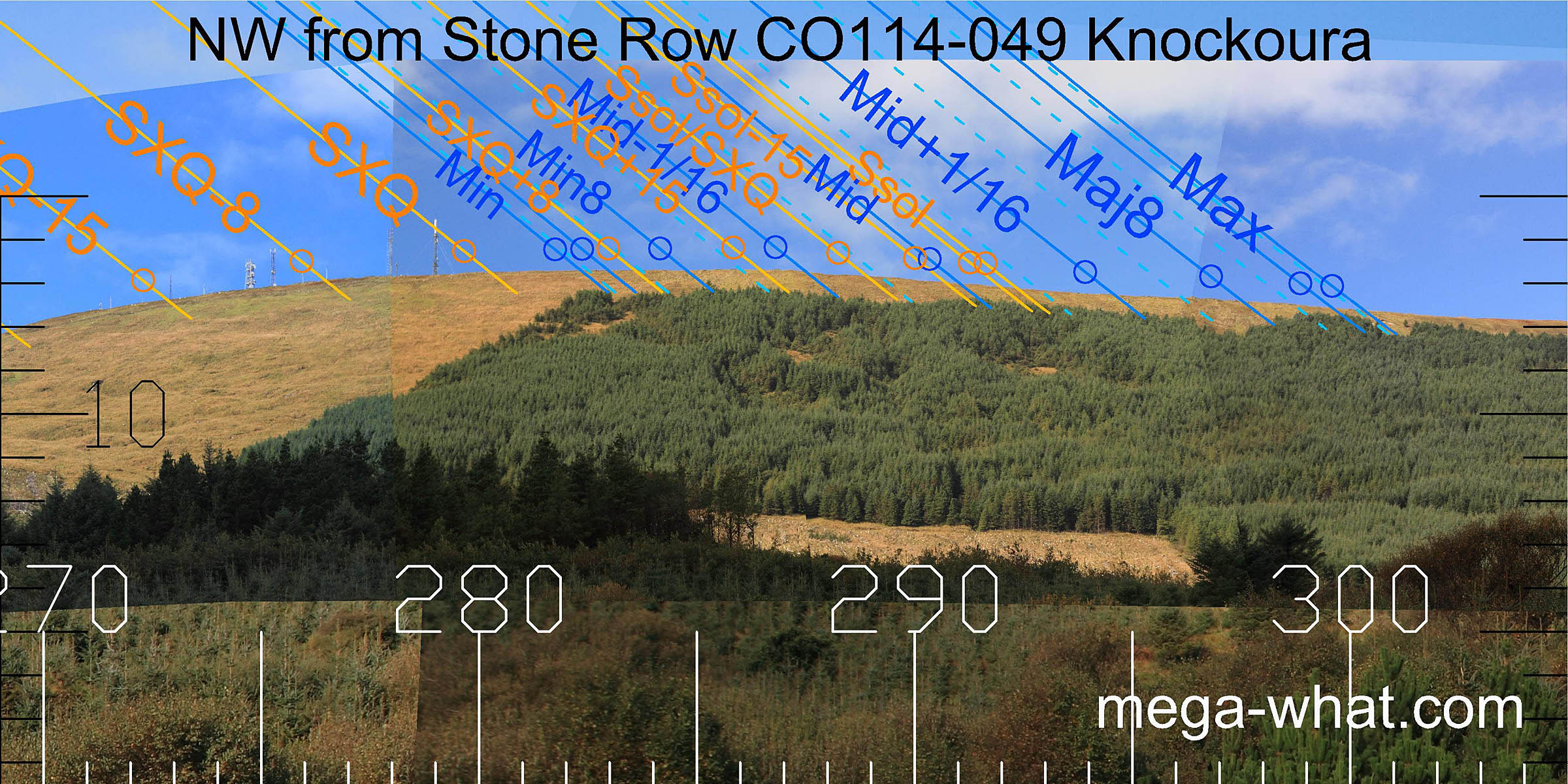 The north-western lunisticeLunistices are the most northerly and southerly moons of the month. The lunar equivalent of solstices - more.
range runs down the north slope from minor standstillLunistice positions vary cyclically over an 18.6 year period but are fairly static for more than a year at either end of the range
on the hilltop.
There are various minor humps, bumps, steps and rocks that are not immediately obvious but would make useful markers nonetheless.
The north-western lunisticeLunistices are the most northerly and southerly moons of the month. The lunar equivalent of solstices - more.
range runs down the north slope from minor standstillLunistice positions vary cyclically over an 18.6 year period but are fairly static for more than a year at either end of the range
on the hilltop.
There are various minor humps, bumps, steps and rocks that are not immediately obvious but would make useful markers nonetheless.
A line from the centre stone through the fourth stone indicates major standstillLunistice positions vary cyclically over an 18.6 year period but are fairly static for more than a year at either end of the range [Pic].
![[Pic]](Knockoura-NWax.jpg)
- Derreenataggart Stone Circle c.4km east-north-east (70°) is the nearest surveyed monument
References
- Archaeological Survey of Ireland, record details. www.archaeology.ie/archaeological-survey-ireland
- POWER, D. et al. 1992 Archaeological Inventory of County Cork, Volume 1: West Cork. Dublin: Stationary Office. p396, no.3533.
- RUGGLES, C.L.N. 1999 Astronomy in Prehistoric Britain and Ireland. Newhaven & London: Yale University Press. CKR83.