
 When it was excavated, the skeleton of a woman was found in the rear chamber but her skull was in the front one.
Labbacallee means bed of the hag or witch, so could be possible that this really is the skeleton of the woman in question and a folk memory of it has survived some 4000 years.
This is a National Monument (No. 318) though not state owned. De Valera & Ó'Nualláin (1982) called it "one of the finest of its type".
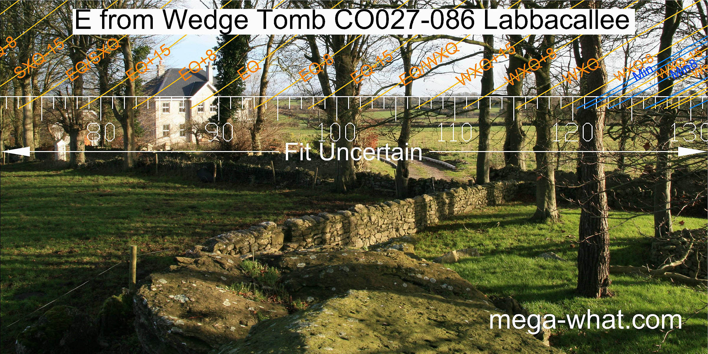
Unfortunately the views are now almost totally obscured by trees and buildings, and some of the latter are quite recent.
When it was excavated, the skeleton of a woman was found in the rear chamber but her skull was in the front one.
Labbacallee means bed of the hag or witch, so could be possible that this really is the skeleton of the woman in question and a folk memory of it has survived some 4000 years.
This is a National Monument (No. 318) though not state owned. De Valera & Ó'Nualláin (1982) called it "one of the finest of its type".
Unfortunately the views are now almost totally obscured by trees and buildings, and some of the latter are quite recent.
The entire eastern half of the horizon is effectively obscured, mostly by trees but also by buildings. Southwards is a long, flat ridge with declinations of about -32° at both ends [Pic].
![[Pic].](Labbacallee-S.jpg)
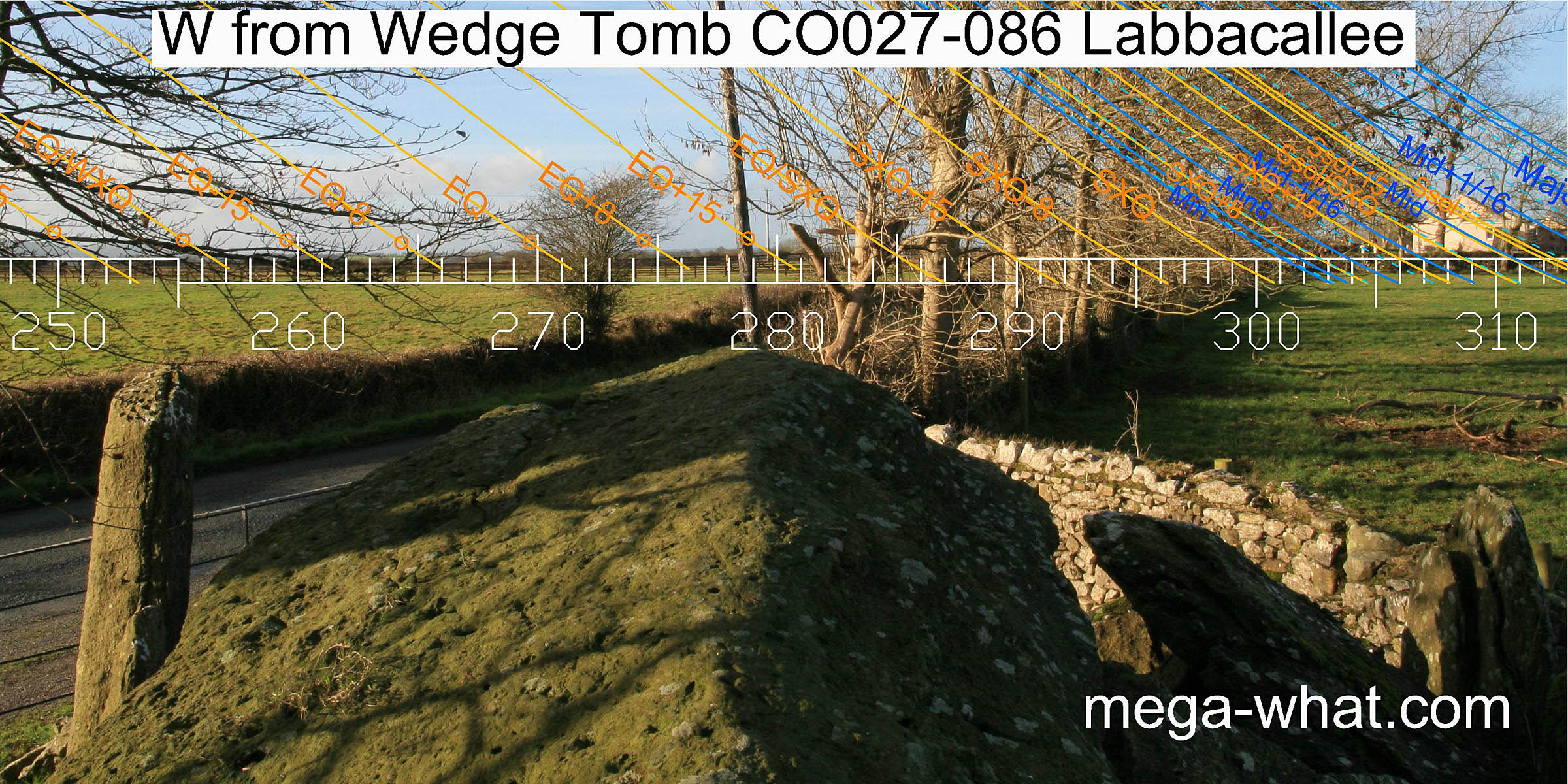
 A line of kerbstones to the tomb's south and linked to its eastern end delimits another wedge-shaped area.
The axis of the straight south-eastern section of this indicates the direction of lunar minor
standstillLunistice positions vary cyclically over an 18.6 year period but are fairly static for more than a year at either end of the range.
This may be a secondary feature because, during excavation, part of the base of a cairn was found between the kerb and the gallery.
More cairn remains were also uncovered on the other side of the tomb but there were no traces of a kerb there.
Thus it is possible that the cairn was removed and this built instead to form what is essentially a level, raised observation platform.
A line of kerbstones to the tomb's south and linked to its eastern end delimits another wedge-shaped area.
The axis of the straight south-eastern section of this indicates the direction of lunar minor
standstillLunistice positions vary cyclically over an 18.6 year period but are fairly static for more than a year at either end of the range.
This may be a secondary feature because, during excavation, part of the base of a cairn was found between the kerb and the gallery.
More cairn remains were also uncovered on the other side of the tomb but there were no traces of a kerb there.
Thus it is possible that the cairn was removed and this built instead to form what is essentially a level, raised observation platform.
Charcoal and broken bone, animal as well as human, was found inside the tomb. The human bone was both interred and cremated, and there were two skeletons. Finds consisted of a bone point, a bone pin, a spindle whorl and pottery sherds. Three 14C determinations (Brindley & Lanting 1991-2:21) have since shown that the burials could have occurred within a calibrated date range of 2202-2138 BC.
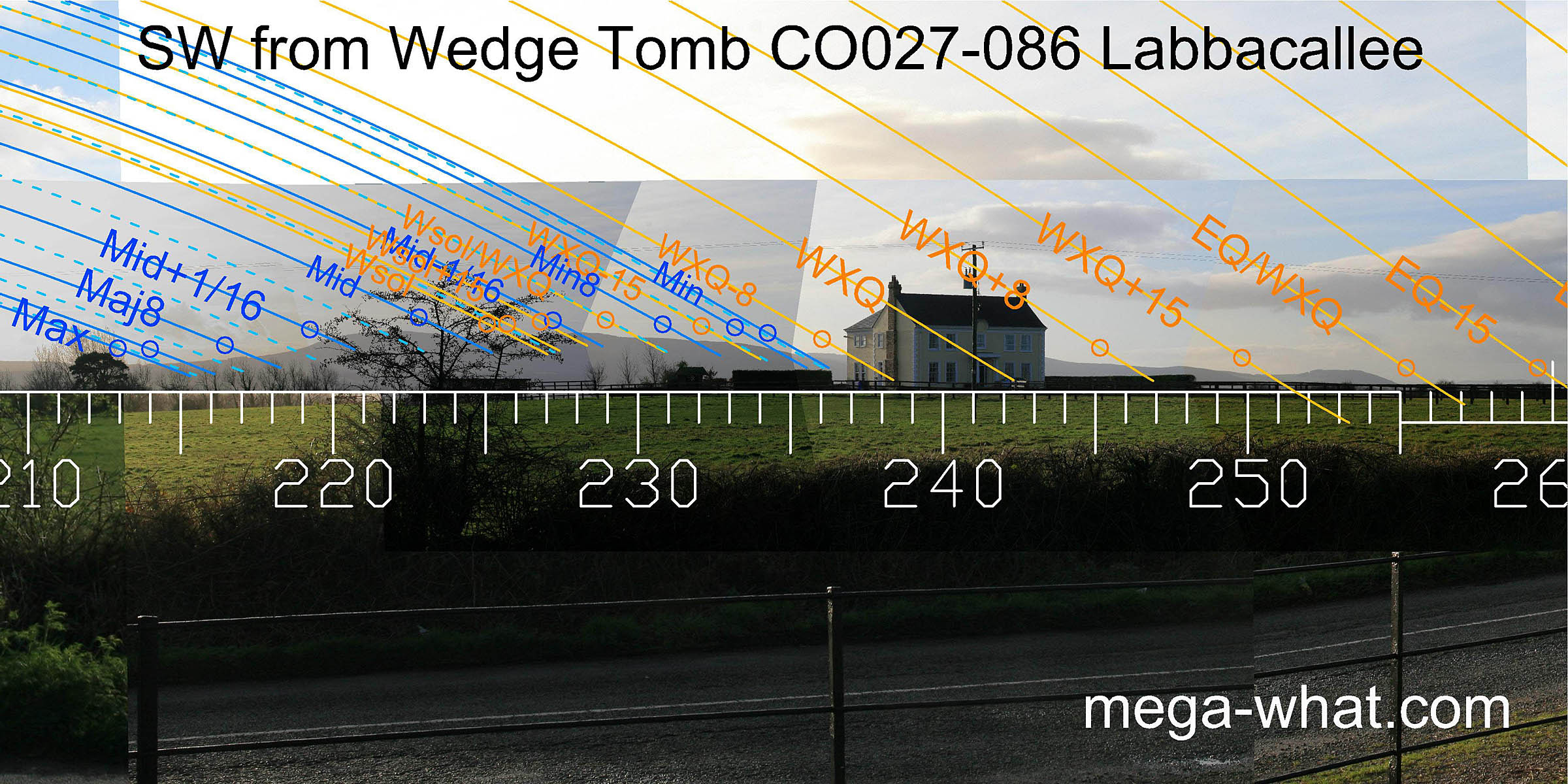 The south-western quadrant is sadly disfigured but the only one with a visible skyline.
The lunar major standstillLunistice positions vary cyclically over an 18.6 year period but are fairly static for more than a year at either end of the range
is in the south basal dip, winter solstice is in the saddle between the two hilltops and
minor standstillLunistice positions vary cyclically over an 18.6 year period but are fairly static for more than a year at either end of the range
is at the north basal notch of that section.
The cross-quarter is unfortunately behind the house but beyond that again, everything seems to fall into place nicely.
The south-western ridge ends with a low flat hill with the equinox / cross-quarter midpoint in the dip to its south and the equinox's half-month bracket at its western foot.
The south-western quadrant is sadly disfigured but the only one with a visible skyline.
The lunar major standstillLunistice positions vary cyclically over an 18.6 year period but are fairly static for more than a year at either end of the range
is in the south basal dip, winter solstice is in the saddle between the two hilltops and
minor standstillLunistice positions vary cyclically over an 18.6 year period but are fairly static for more than a year at either end of the range
is at the north basal notch of that section.
The cross-quarter is unfortunately behind the house but beyond that again, everything seems to fall into place nicely.
The south-western ridge ends with a low flat hill with the equinox / cross-quarter midpoint in the dip to its south and the equinox's half-month bracket at its western foot.
 Next follows a stretch of low, apparently flat skyline with the axis of the tomb pointing towards it (axis c.278.5° mean, spread c.21°).
It is possible that a better view of distant features in this direction might be obtained from the top of the tomb but conditions were not quite good enough to be sure.
Trees and buildings obscure the north-western quadrant.
Next follows a stretch of low, apparently flat skyline with the axis of the tomb pointing towards it (axis c.278.5° mean, spread c.21°).
It is possible that a better view of distant features in this direction might be obtained from the top of the tomb but conditions were not quite good enough to be sure.
Trees and buildings obscure the north-western quadrant.
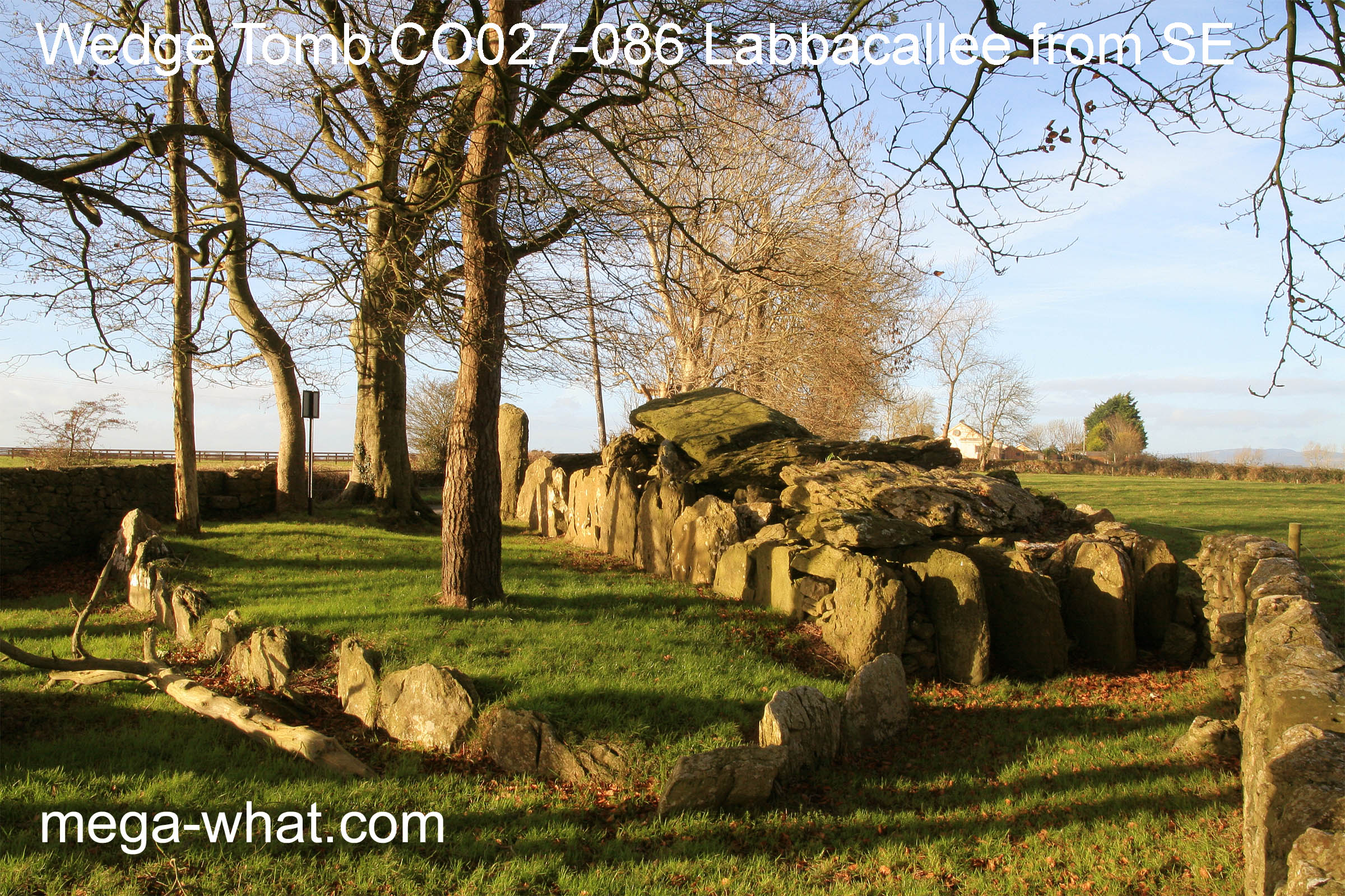
The western end of the tomb [Pic] was found to be disturbed and so the design of the front is uncertain. A skeleton and some pottery fragments were found there and may represent a later cist. Official information states that the setting equinoctial sun shines directly into the chamber but this is almost certainly an artefact of the current disposition of the entrance stones which, as the excavation indicated, is unlikely to be the same now as when the tomb was built.
![[Pic]](027086Wfront.jpg)
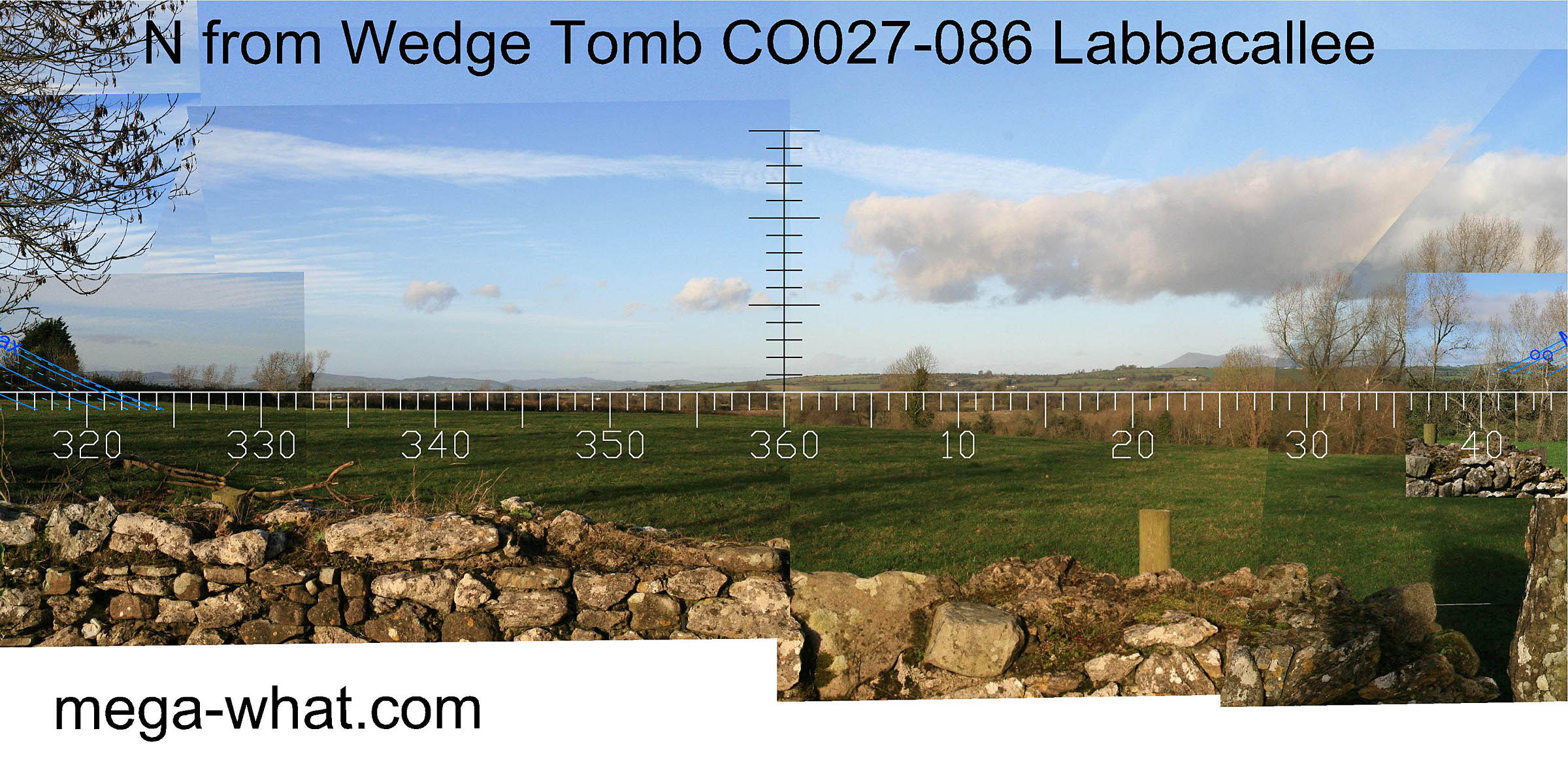 The northern horizon is open and hilly, with a prominent intersect notch about 4° west of north.
The most westerly visible mountain top is two lunar diameters beyond the lunar limit.
The northern horizon is open and hilly, with a prominent intersect notch about 4° west of north.
The most westerly visible mountain top is two lunar diameters beyond the lunar limit.
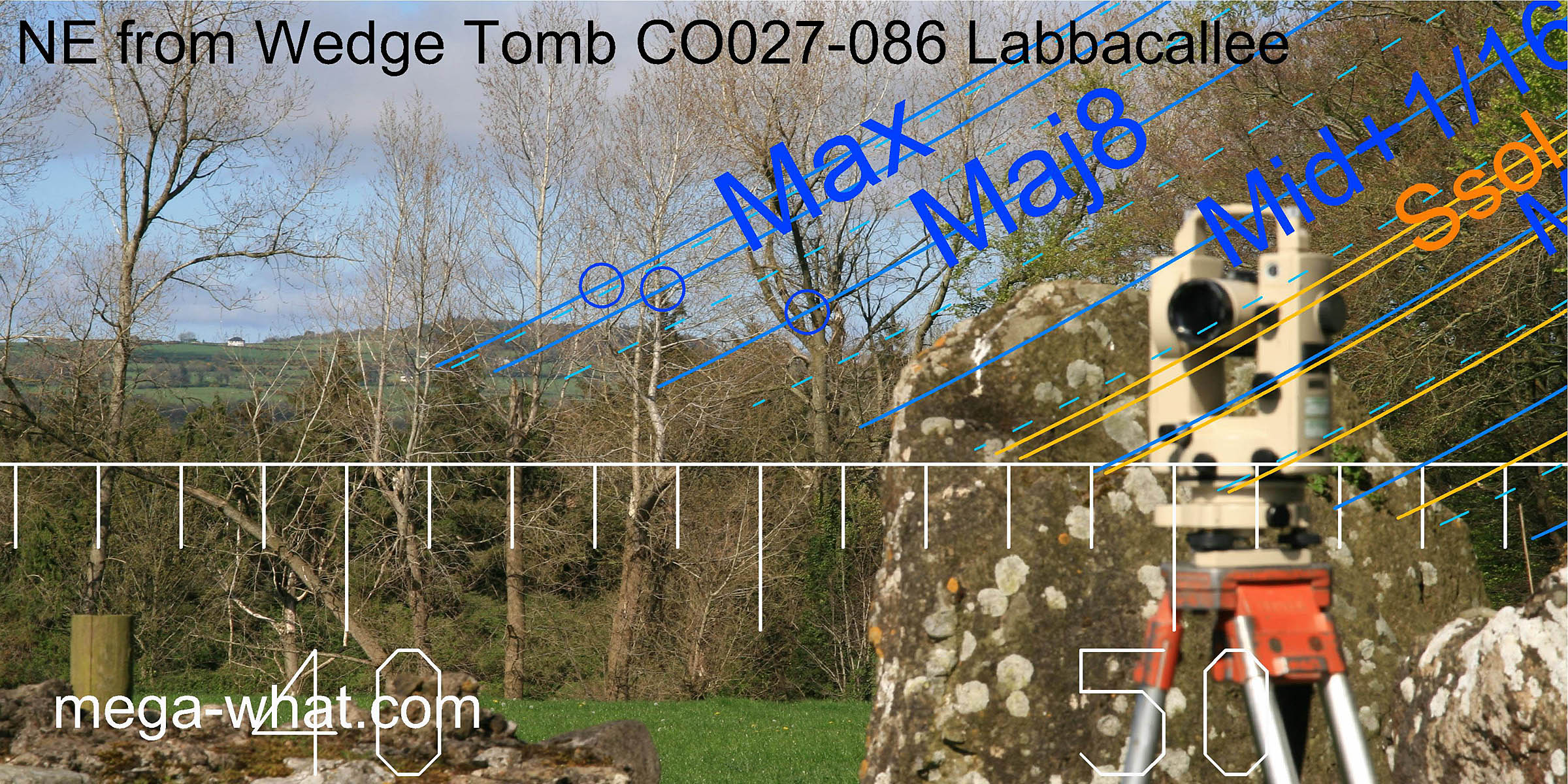 To the north-east, a hill is just visible through the trees and it marks the lunar limit.
Island Wedge Tomb c.20km south-west is the nearest surveyed (and excavated) monument.
References
- Archaeological Survey of Ireland, record details. www.archaeology.ie/archaeological-survey-ireland
- BRINDLEY A.L. & LANTING J.N. 1991-2 Radiocarbon dates from wedge tombs. Journal of Irish Archaeology 6:19-26.
- DE VALERA, RUAIDHRÍ & Ó'NUALLÁIN, SEÁN 1982 Survey of the Megalithic Tombs of Ireland, Volume IV: Cork, Kerry, Limerick and Tipperary. Dublin: Stationary Office. p2, no.3.
- LEASK & PRICE 1936 The Labbacallee Megalith, Co. Cork. Proceedings of the Royal Irish Academy 43:77-101.
- POWER, D. et al. 2000 Archaeological Inventory of County Cork, Volume IV: North Cork, Part 1. Dublin: Stationary Office. p5, no.9822.