
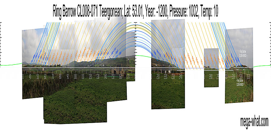
 Ring Barrow CL008-071 is above Doolin village, to the north of the road that runs up to the R478. It has only had a quick, preliminary survey in less than ideal conditions.
Survey is incomplete but South is indicated by the hilltop [Pic]. Green lines approximate hidden horizon segments.
![[Pic].](TeergoneanB71-S.jpg)
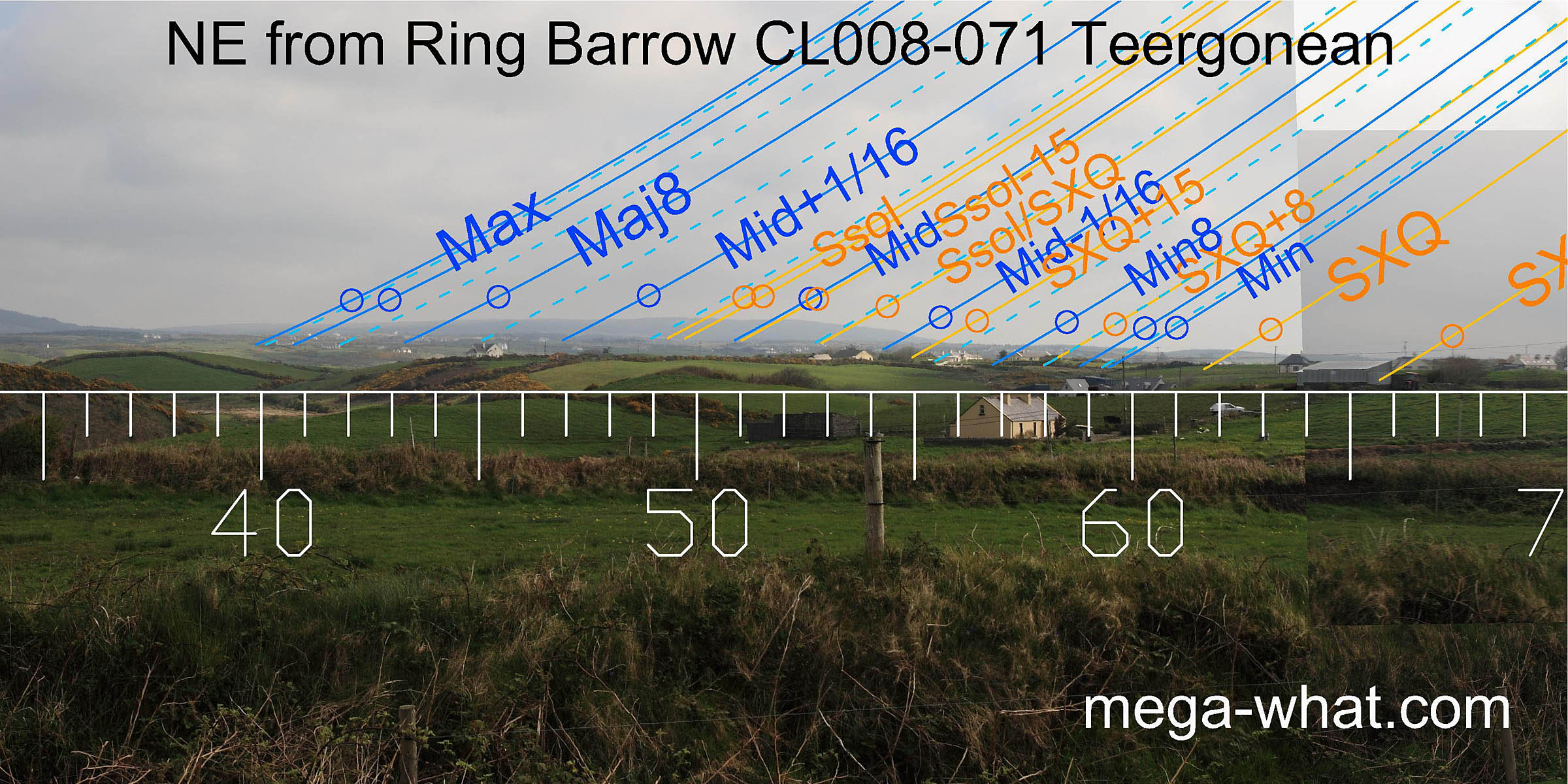 To the north-east a ridge of higher ground provides markers for the lunisticeLunistices are the most northerly and southerly moons of the month. The lunar equivalent of solstices - more.
range and for summer sunrises.
To the north-east a ridge of higher ground provides markers for the lunisticeLunistices are the most northerly and southerly moons of the month. The lunar equivalent of solstices - more.
range and for summer sunrises.
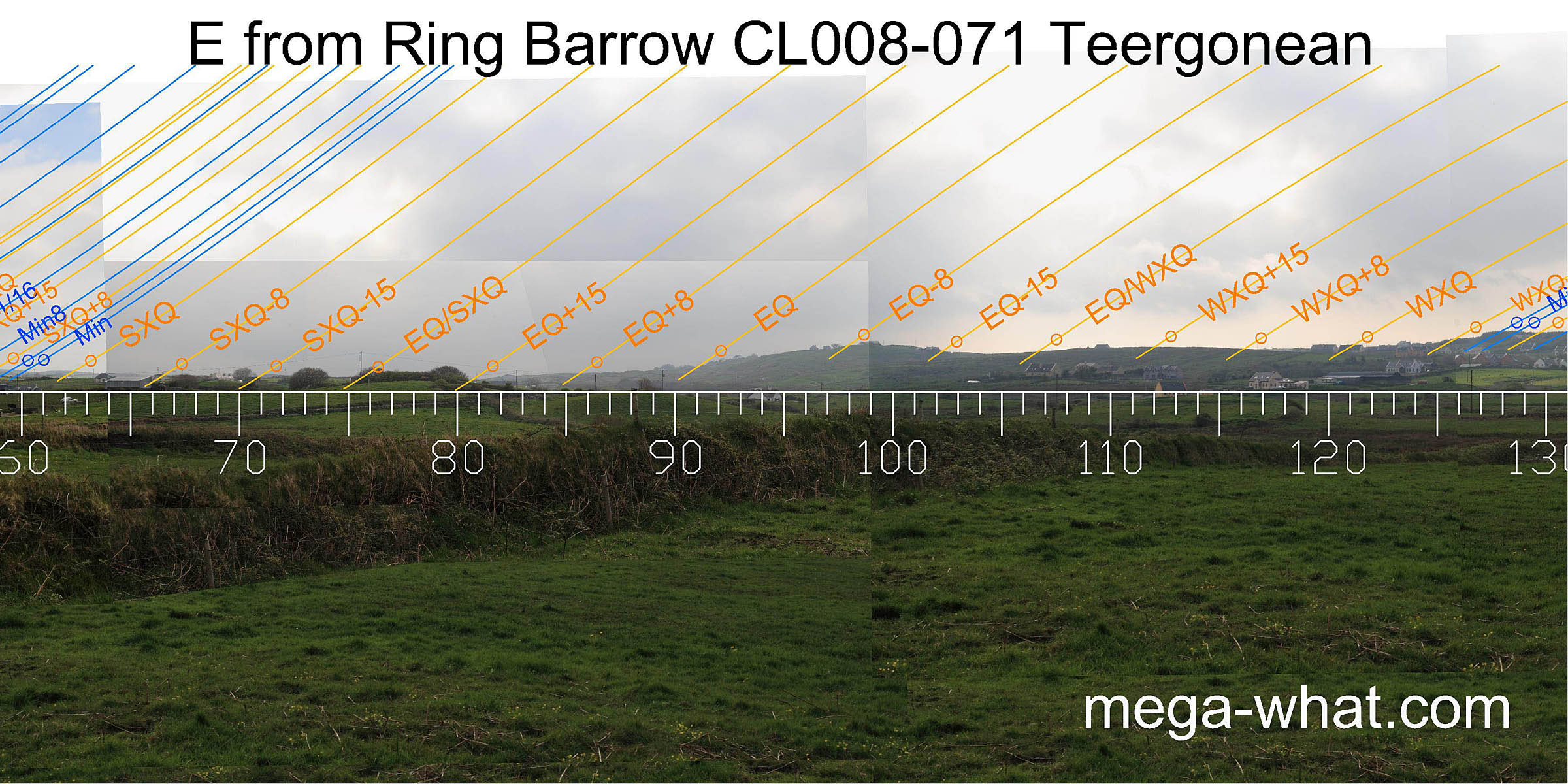 To the east the ground rises towards a hilltop that is a quarter-month south of the equinox before falling again to the winter cross-quarters.
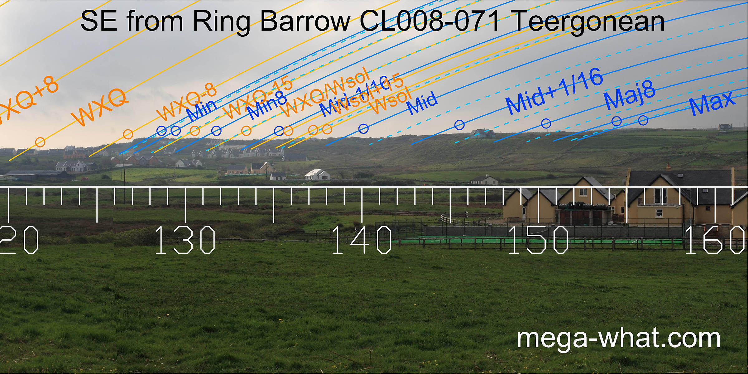 The south-east horizon is a long ridge, rather lacking in obvious significant features but it would appear that the minor end of the lunisticeLunistices are the most northerly and southerly moons of the month. The lunar equivalent of solstices - more.
range is on a high point with the winter solstice at the south end of a slight saddle.
The south-east horizon is a long ridge, rather lacking in obvious significant features but it would appear that the minor end of the lunisticeLunistices are the most northerly and southerly moons of the month. The lunar equivalent of solstices - more.
range is on a high point with the winter solstice at the south end of a slight saddle.
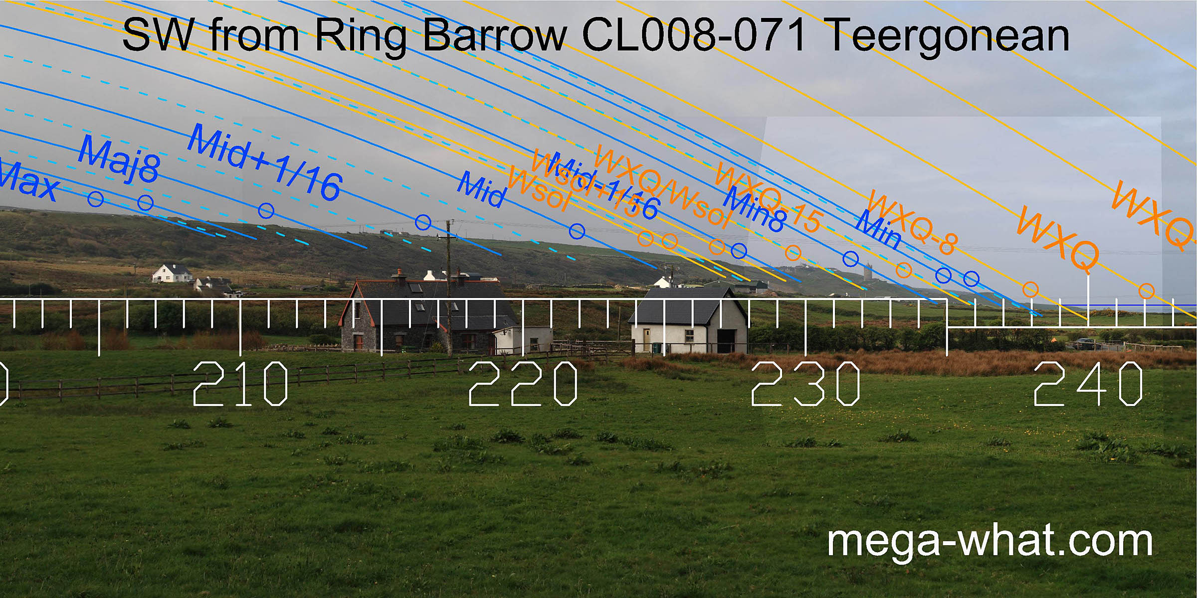 The stepped south-western slope provides a number of useful markers. Both ends of the lunisticeLunistices are the most northerly and southerly moons of the month. The lunar equivalent of solstices - more.
range have markers that help distinguish between the standstillsLunistice positions vary cyclically over an 18.6 year period but are fairly static for more than a year at either end of the range
and their adjacent sixteenths. The minor end is particularly good and the land/sea intersect is a quarter-month south of the winter cross-quarters. [Enlargement]
The stepped south-western slope provides a number of useful markers. Both ends of the lunisticeLunistices are the most northerly and southerly moons of the month. The lunar equivalent of solstices - more.
range have markers that help distinguish between the standstillsLunistice positions vary cyclically over an 18.6 year period but are fairly static for more than a year at either end of the range
and their adjacent sixteenths. The minor end is particularly good and the land/sea intersect is a quarter-month south of the winter cross-quarters. [Enlargement]
![[Enlargement]](TeergoneanB71-SWbig.jpg)
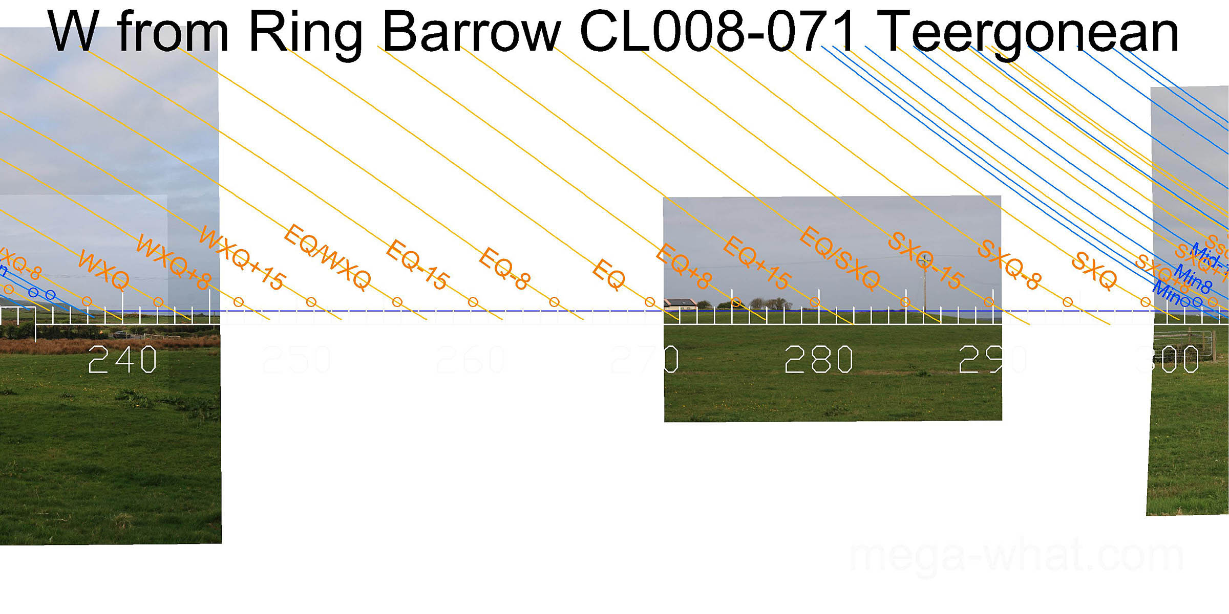
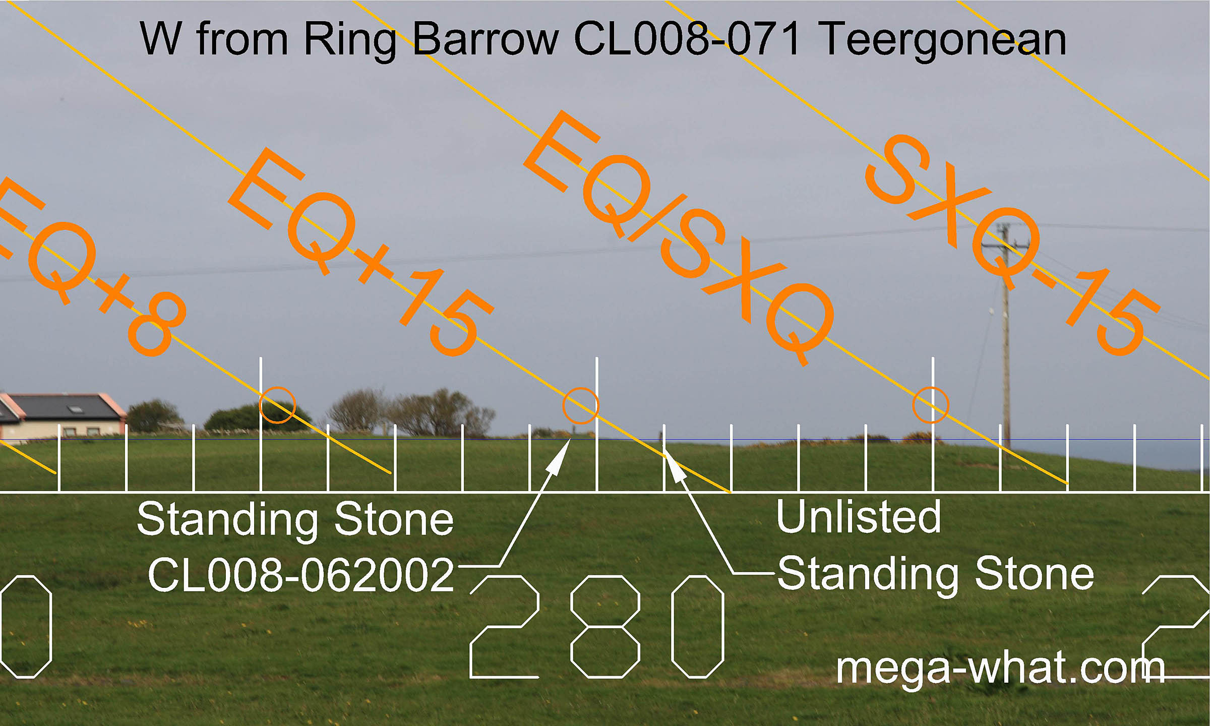 The western horizon is either the sea or fairly local ground. An unlisted Standing Stone (IR 08021 ITM 96763) cuts the sea horizon.
A little to the left of it is Standing Stone CL008-062002, a further 365m away, on top of a Stepped Barrow on the summit of Stoolery Hill.
These two effectively mark the half-month north of the equinox from here and a sightline between the two stones is a quarter-month north of the equinox.
The western horizon is either the sea or fairly local ground. An unlisted Standing Stone (IR 08021 ITM 96763) cuts the sea horizon.
A little to the left of it is Standing Stone CL008-062002, a further 365m away, on top of a Stepped Barrow on the summit of Stoolery Hill.
These two effectively mark the half-month north of the equinox from here and a sightline between the two stones is a quarter-month north of the equinox.
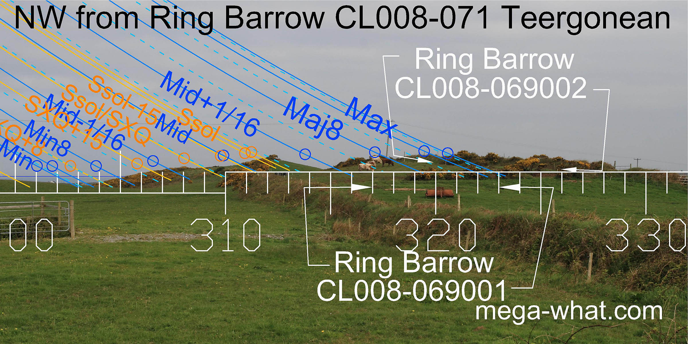 Northwestwards, local and mid-distance hilltops make good markers. Summer solstice sunset is on the first top and the currently unsurveyed
Ring Barrow CL008-069002 is on the nearer one with lunar major standstillLunistice positions vary cyclically over an 18.6 year period but are fairly static for more than a year at either end of the range
falling inside it.
Northwestwards, local and mid-distance hilltops make good markers. Summer solstice sunset is on the first top and the currently unsurveyed
Ring Barrow CL008-069002 is on the nearer one with lunar major standstillLunistice positions vary cyclically over an 18.6 year period but are fairly static for more than a year at either end of the range
falling inside it.
Ring Barrow CL008-069001 is 130m to the NW and the unsurveyed CL008-067 is 340m to the WNW.
More completely surveyed is Stepped Barrow CL008-062, across the road and on top of Stoolery Hill.
References
- Archaeological Survey of Ireland, record details. www.archaeology.ie/archaeological-survey-ireland