
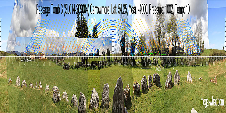
 This is Tomb 3 as numbered by the George Petrie survey of 1837. Excavated by Burenhult and his Swedish team between 1977 and 1982 but numbered in that work as tomb 4.
Radio carbon dates from the excavation gave a primary construction date of about 5000 BC, the oldest date obtained at Carrowmore.
This is Tomb 3 as numbered by the George Petrie survey of 1837. Excavated by Burenhult and his Swedish team between 1977 and 1982 but numbered in that work as tomb 4.
Radio carbon dates from the excavation gave a primary construction date of about 5000 BC, the oldest date obtained at Carrowmore.
South is indicated by a distant hill that is just visible over nearer ground [Pic].
![[Pic].](Carrowmore3-S.jpg)
North is on local high ground, right of the top and left of the intersect with far horizons [Pic].
![[Pic].](Carrowmore3-N.jpg)
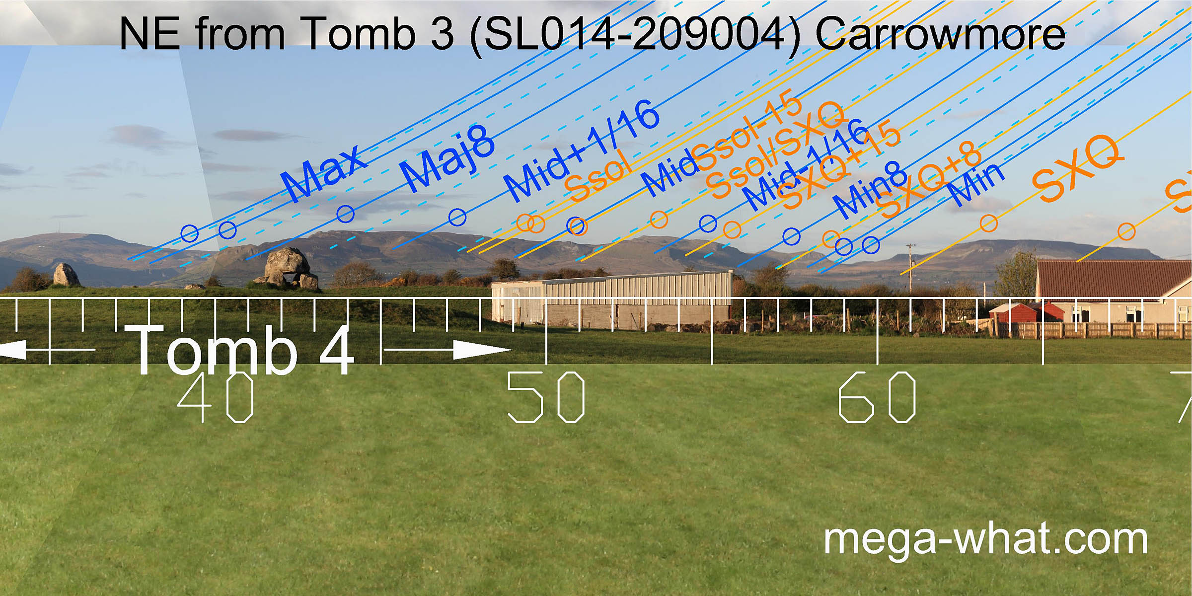 To the north-east is a useful run of hills that are markers for just about everything.
The lunar eighths and the solstice/cross-quarter midpoint are all on north facing slopes for added precision.
Both ends of the lunisticeLunistices are the most northerly and southerly moons of the month. The lunar equivalent of solstices - more.
zone are in dips.
To the north-east is a useful run of hills that are markers for just about everything.
The lunar eighths and the solstice/cross-quarter midpoint are all on north facing slopes for added precision.
Both ends of the lunisticeLunistices are the most northerly and southerly moons of the month. The lunar equivalent of solstices - more.
zone are in dips.
Tomb 4 (unexcavated) is about 55m away in this direction.
Tomb 7, excavated by Burenhult and dated to about 4200 BC is 150m beyond it.
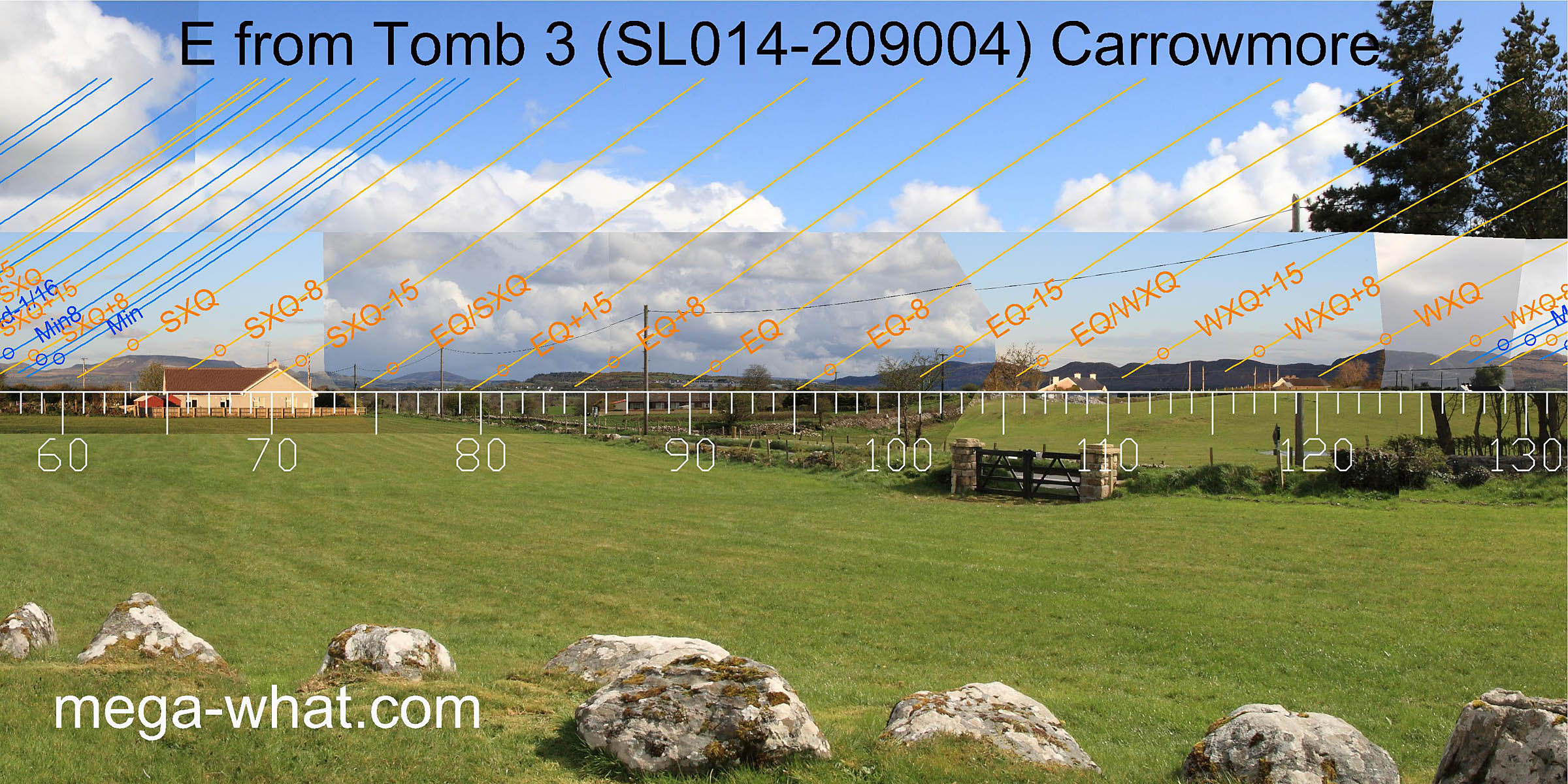 Eastwards, both the summer and winter cross-quarter sun rises are on north facing slopes for increased precision.
The month centred on the equinox is well marked and the equinox / cross-quarter midpoints are both in dips.
Eastwards, both the summer and winter cross-quarter sun rises are on north facing slopes for increased precision.
The month centred on the equinox is well marked and the equinox / cross-quarter midpoints are both in dips.
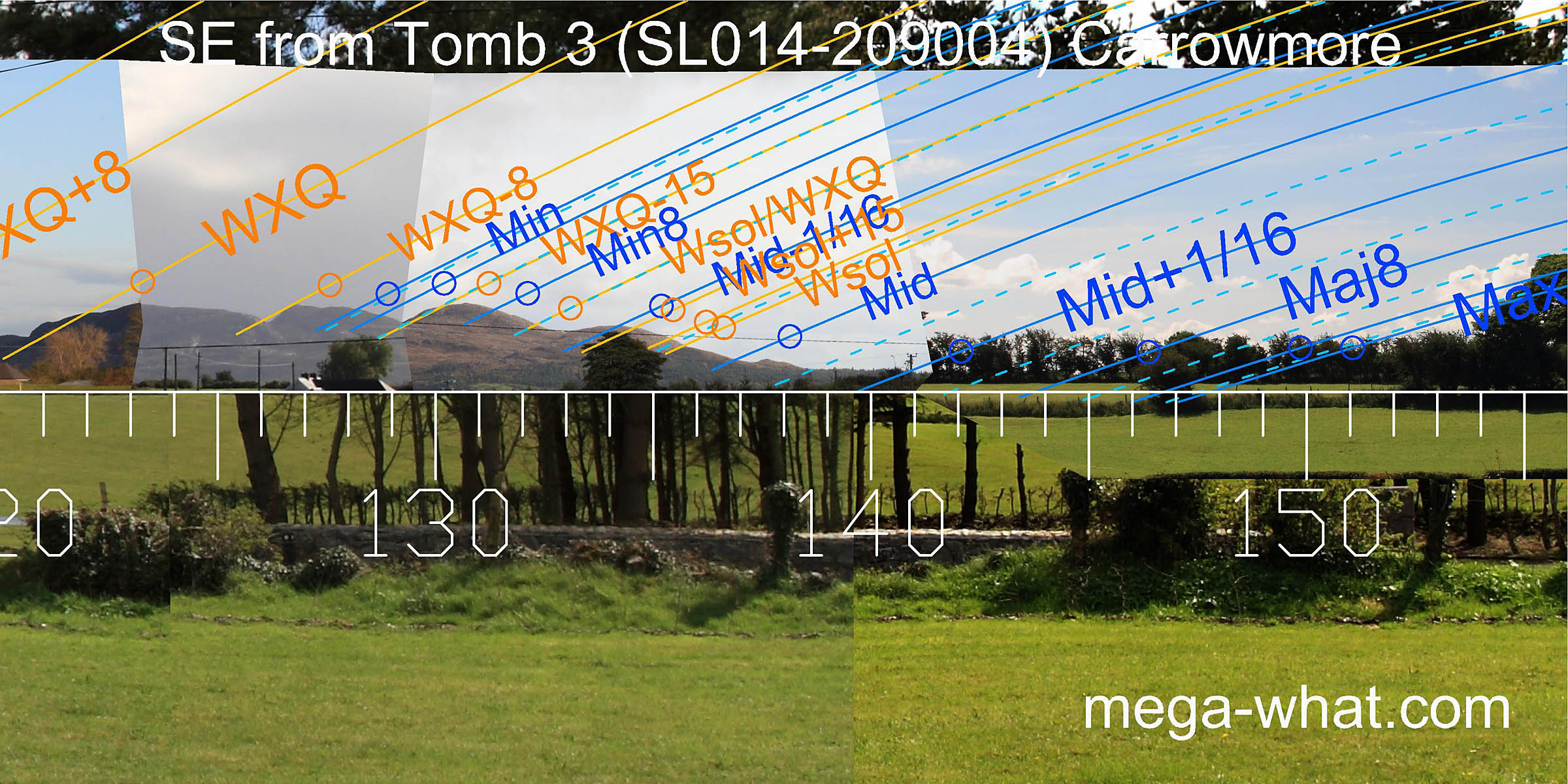 The nearby trees that used to obscure the south-east are now gone but more distant ones occupy the low ground at the major end of the
lunisticeLunistices are the most northerly and southerly moons of the month. The lunar equivalent of solstices - more.
zone, concealing the true profile.
The nearby trees that used to obscure the south-east are now gone but more distant ones occupy the low ground at the major end of the
lunisticeLunistices are the most northerly and southerly moons of the month. The lunar equivalent of solstices - more.
zone, concealing the true profile.
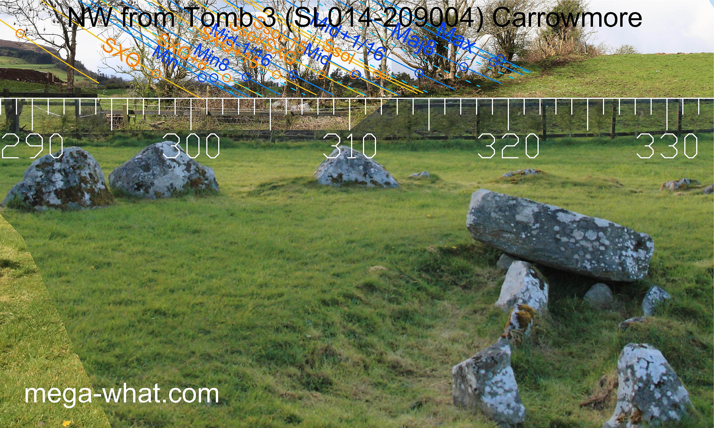
The minor end of the lunisticeLunistices are the most northerly and southerly moons of the month. The lunar equivalent of solstices - more. zone is in a dip as is the solstice / cross-quarter midpoint and the solstice itself is marked by a notch.
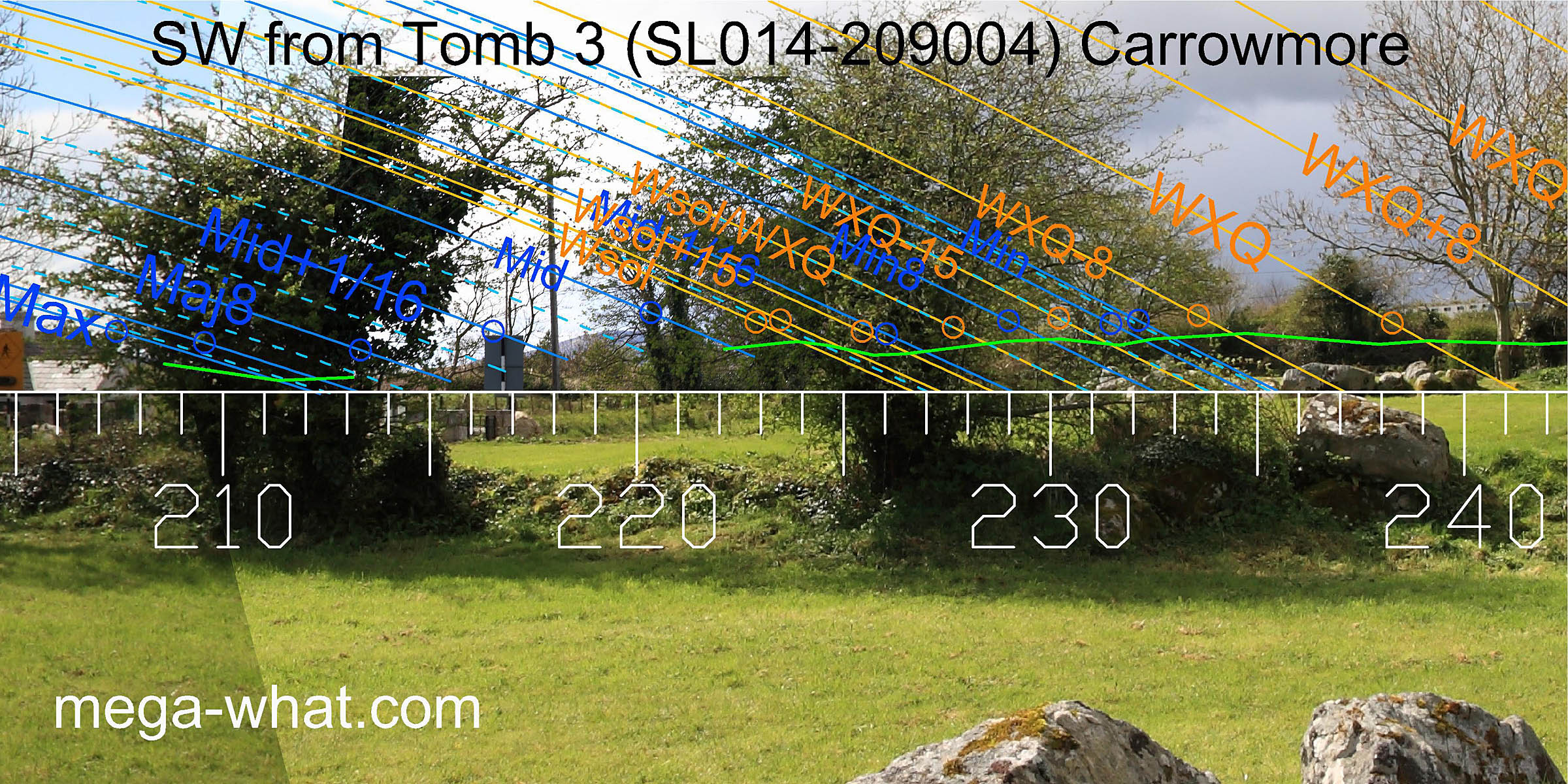
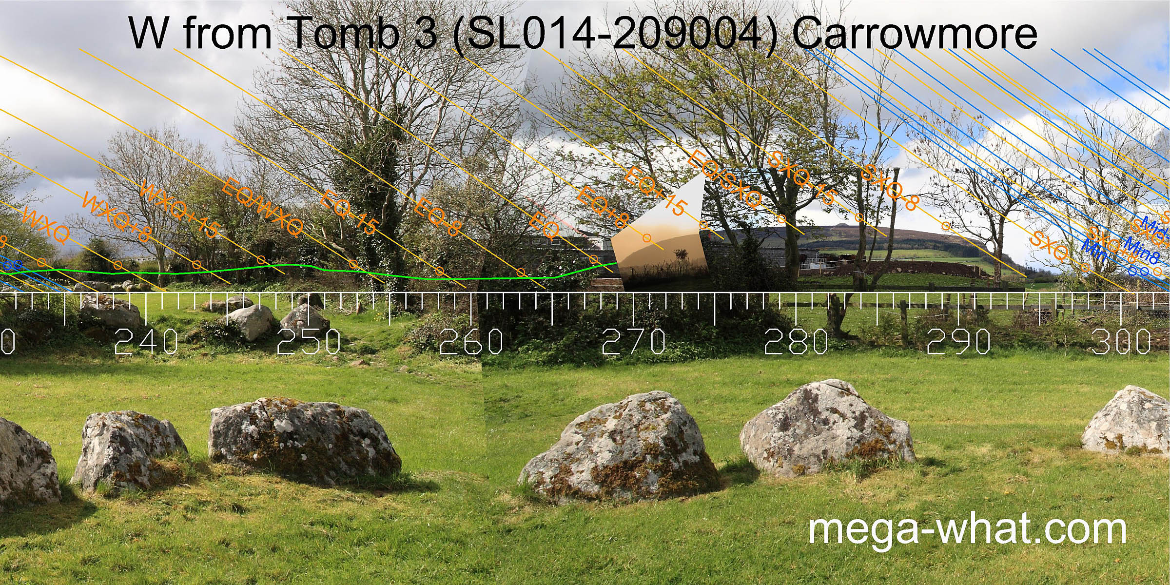 The south-west and west are largely obscured but Knocknaree has the equinox at its foot and the equinox / summer cross-quarter midpoint on its top.
Nearby in this direction are tombs 2 & 1 but views from them are greatly obscured.
Part of tomb 1 was excavated in 1995-96 and a charcoal sample was dated to c.4350 BC.
 The slope of the northern end of Knocknaree makes a good marker for the quarter-month south of the summer cross-quarter.
The axis of the tomb's chamber roughly indicates a local high point slightly beyond the lunar limit, in the nature of an exaggerated gesture.
The area in between is again obscured by vegetation and not really surveyable but the intention is fairly clear.
The slope of the northern end of Knocknaree makes a good marker for the quarter-month south of the summer cross-quarter.
The axis of the tomb's chamber roughly indicates a local high point slightly beyond the lunar limit, in the nature of an exaggerated gesture.
The area in between is again obscured by vegetation and not really surveyable but the intention is fairly clear.
Carrowmore Megalithic Cemetery is quite extensive, with many tombs. Click here for a map and more information.
References
- Archaeological Survey of Ireland, record details. www.archaeology.ie/archaeological-survey-ireland
- BURENHULT, GÖRAN 2001 Illustrated Guide to the Megalithic Cemetery of Carrowmore Co. Sligo. Tjörnarp, Sweden. p19.
- EGAN, URSULA et. al. 2008 Archaelogical Inventory of County Sligo. Dublin: Stationary Office.
- Ó'NUALLÁIN, SEÁN 1989 Survey of the Megalithic Tombs of Ireland, Volume V: Sligo. Dublin: Stationary Office.