
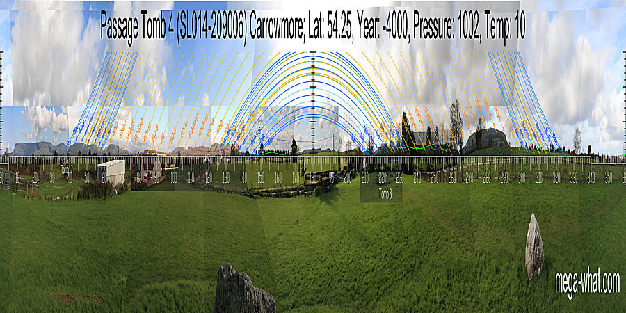
 This monument is identified as Tomb 4, the number given to it in the George Petrie survey of 1837. It has not been excavated.
South is indicated by a distant hilltop. In front of it, Tomb 51 was built later [Pic].
![[Pic].](Carrowmore4-S.jpg)
North is in a dip, near an intersect of local and distant ground [Pic].
![[Pic].](Carrowmore4-N.jpg)
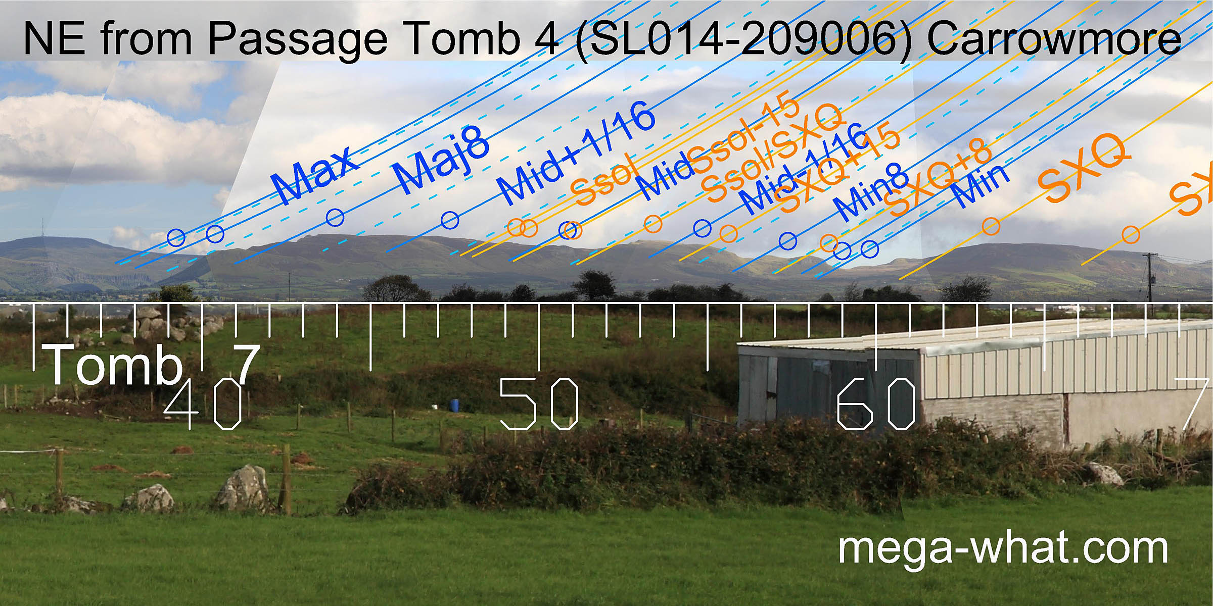 To the north-east a useful run of hills provides markers for just about everything.
Unsurprisingly this view is almost identical to the one from Tomb 3 which is only 55m away.
To the north-east a useful run of hills provides markers for just about everything.
Unsurprisingly this view is almost identical to the one from Tomb 3 which is only 55m away.
The lunar eighths and the solstice/cross-quarter midpoint are all on north facing slopes for added precision. Both ends of the lunisticeLunistices are the most northerly and southerly moons of the month. The lunar equivalent of solstices - more. zone are in dips.
Tomb 7, excavated by Burenhult and dated to about 4200 BC, is 150m further in this direction.
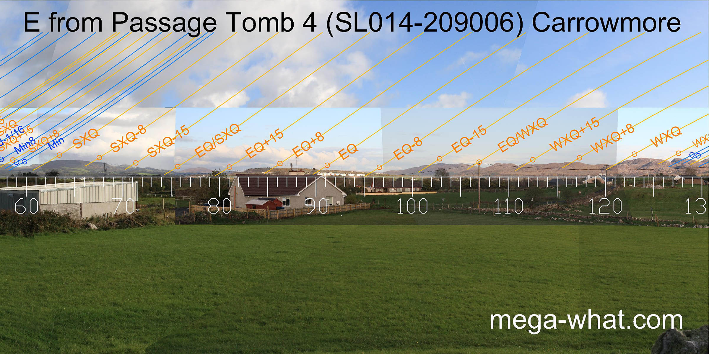 Eastwards, both summer and winter cross-quarter sun rises are on north facing slopes for increased precision.
The month centred on the equinox is well marked and the equinox / cross-quarter midpoints are both in dips.
Eastwards, both summer and winter cross-quarter sun rises are on north facing slopes for increased precision.
The month centred on the equinox is well marked and the equinox / cross-quarter midpoints are both in dips.
Once again, this view is very similar to the one from Tomb 3.
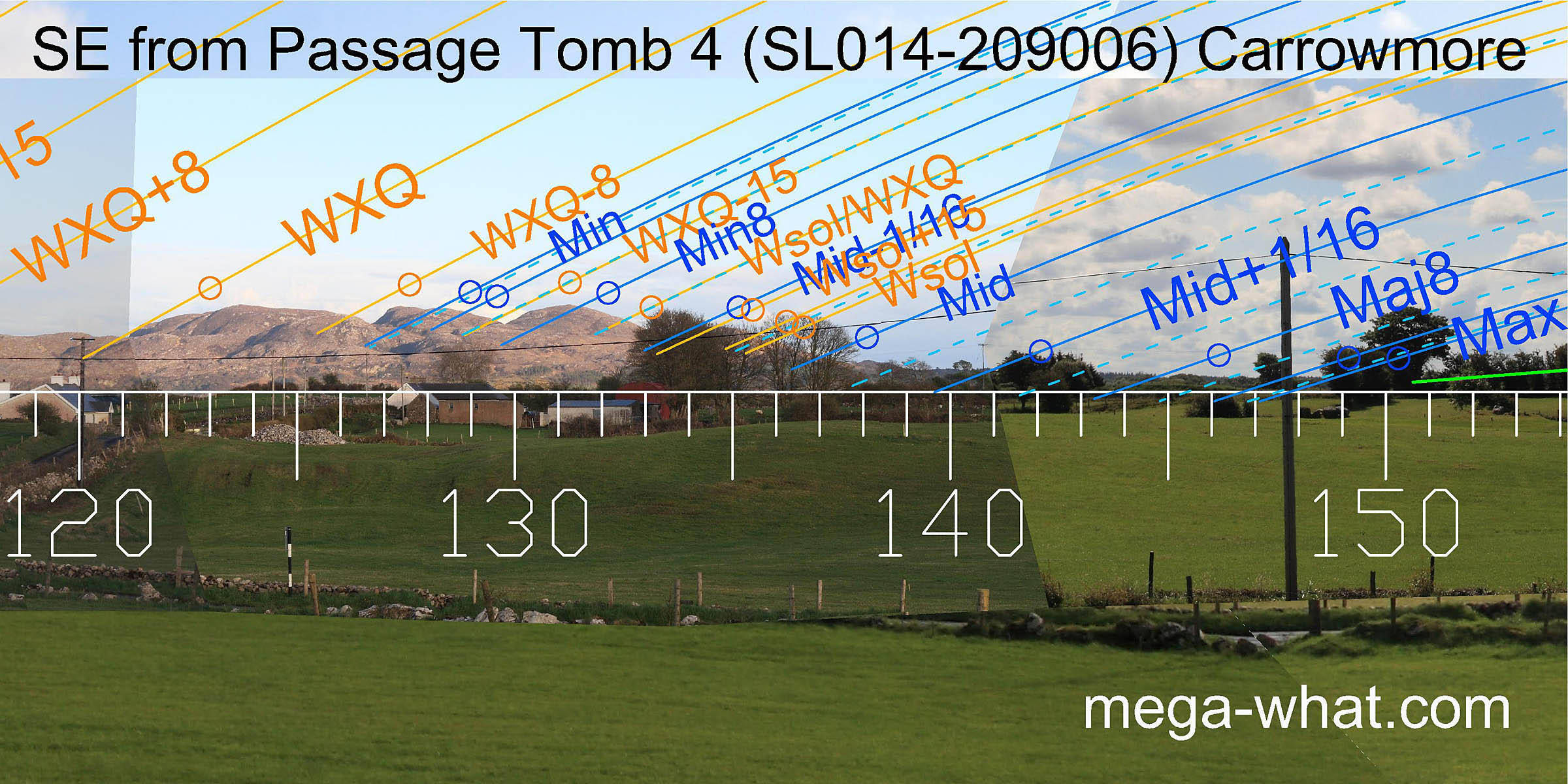 Further to the south-east the similarity continues.
Hills provide more markers but do not run far enough to cover the major half of the lunisticeLunistices are the most northerly and southerly moons of the month. The lunar equivalent of solstices - more.
range which occurs on rather flat and featureless ground.
Further to the south-east the similarity continues.
Hills provide more markers but do not run far enough to cover the major half of the lunisticeLunistices are the most northerly and southerly moons of the month. The lunar equivalent of solstices - more.
range which occurs on rather flat and featureless ground.
The minor end of the lunisticeLunistices are the most northerly and southerly moons of the month. The lunar equivalent of solstices - more. zone is in a dip then trees conceal some vital detail.
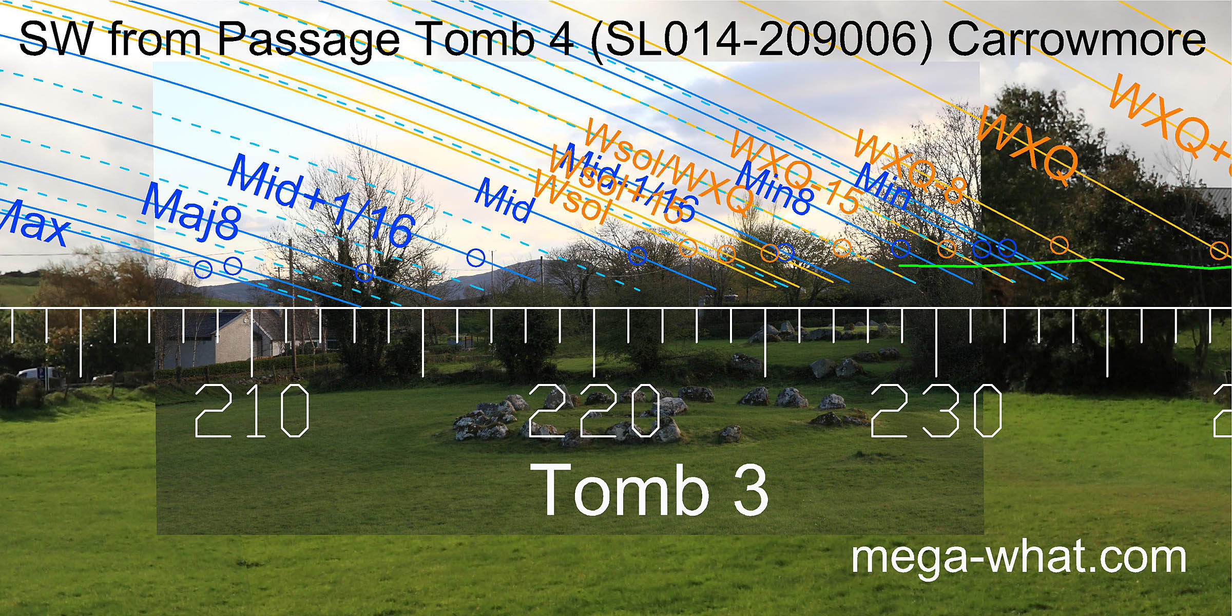 The south-west is largely obscured by trees and farm buildings but lunar major standstillLunistice positions vary cyclically over an 18.6 year period but are fairly static for more than a year at either end of the range
, major eighth and mid cycle are all indicated by dips.
The south-west is largely obscured by trees and farm buildings but lunar major standstillLunistice positions vary cyclically over an 18.6 year period but are fairly static for more than a year at either end of the range
, major eighth and mid cycle are all indicated by dips.
55m away in this direction is Tomb 3, which was excavated by Burenhult and dated to about 5000 BC. Slightly further away are tombs 2 & 1. Part of tomb 1 was excavated in 1995-96 and a charcoal sample was dated to c.4350 BC.
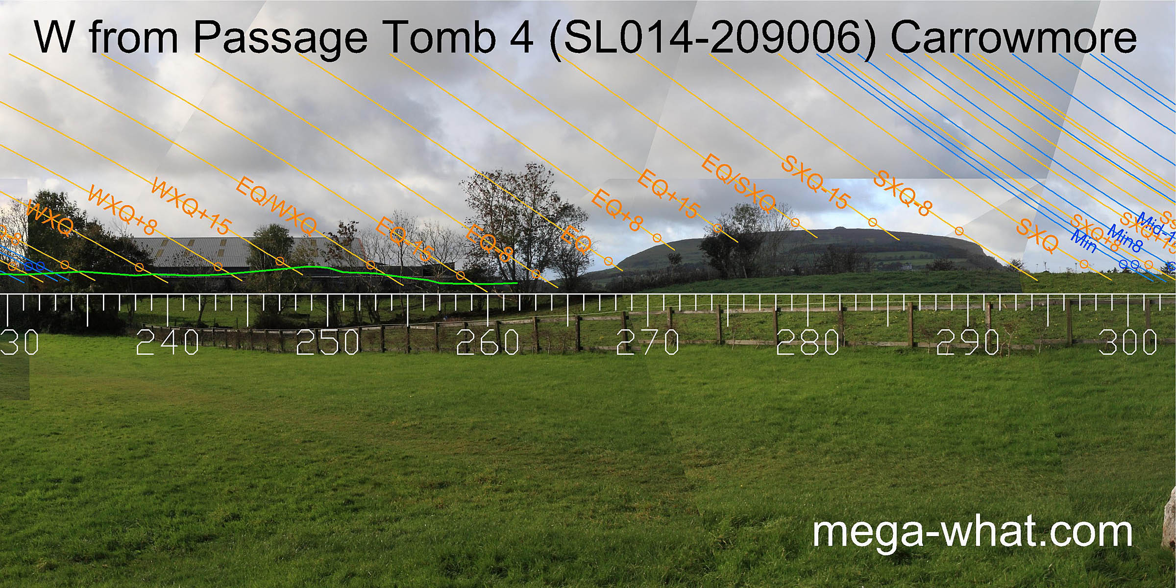 Westwards is Knocknaree. Its southern basal step marks the equinox and a dip south of that again is a quarter-month.
The northern end of the hill provides half and quarter-month brackets for the summer cross-quarters and the hilltop is half-way between equinox and cross-quarter.
"Maeve's Tomb" is clearly not a significant marker which tends to confirm the view of those who regard it as a later structure.
Westwards is Knocknaree. Its southern basal step marks the equinox and a dip south of that again is a quarter-month.
The northern end of the hill provides half and quarter-month brackets for the summer cross-quarters and the hilltop is half-way between equinox and cross-quarter.
"Maeve's Tomb" is clearly not a significant marker which tends to confirm the view of those who regard it as a later structure.
Of the three tombs surveyed, this one has the best fit on this horizon sector.
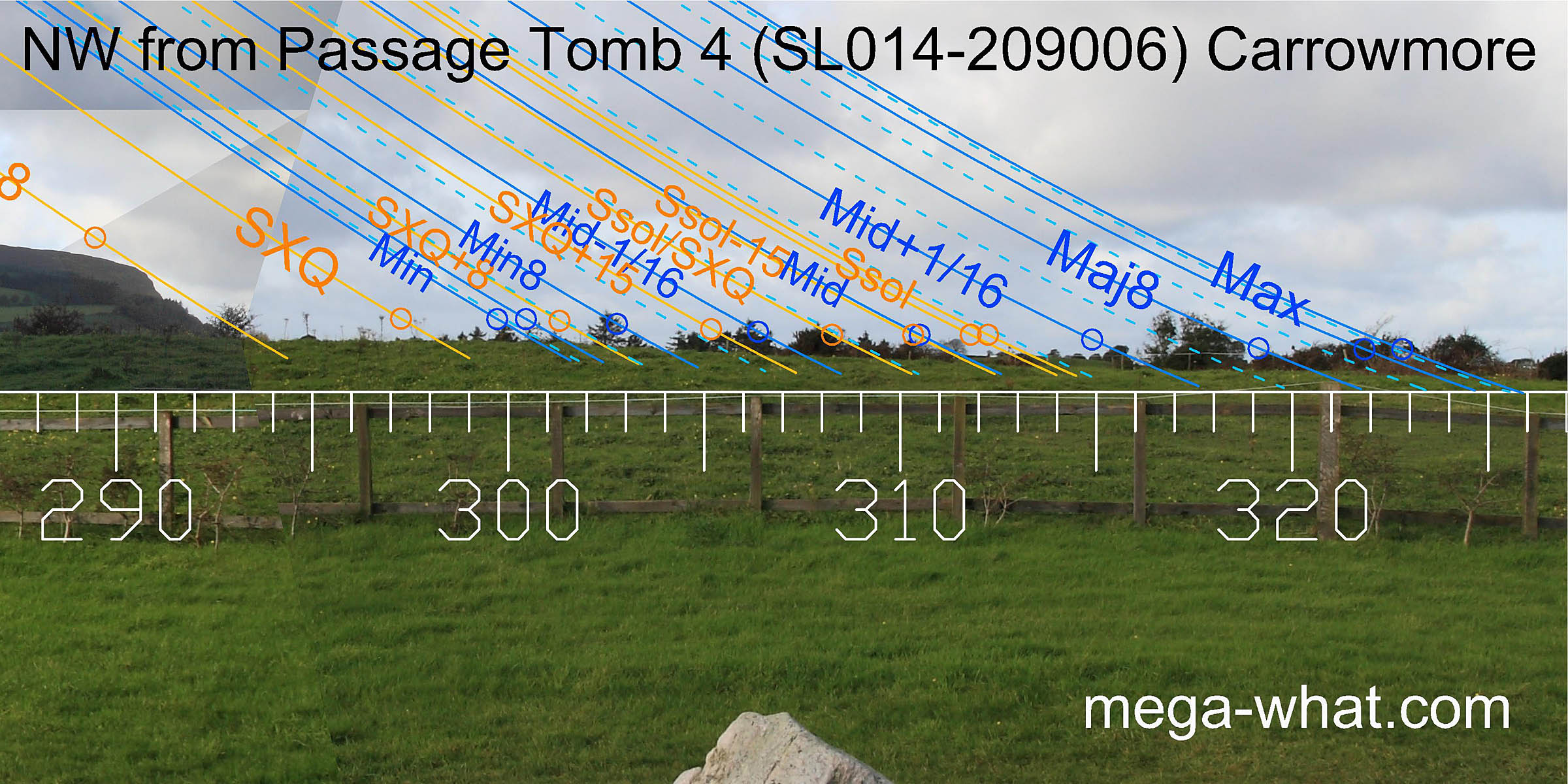 To the north-west, the horizon is a close interaction between local and more distant ground.
Not obviously very useful from ground level, the view is improved by standing on top of the tomb but this horizon segment is considerably confused by hedges and trees.
To the north-west, the horizon is a close interaction between local and more distant ground.
Not obviously very useful from ground level, the view is improved by standing on top of the tomb but this horizon segment is considerably confused by hedges and trees.
Although this tomb was not excavated by the Swedish team, their numbering scheme may cause some confusion. Burenhult referred to this site as tomb 5, while his tomb 4 was actually Tomb 3. The SMR numbering system is also unhelpfully similar but different.
Carrowmore Megalithic Cemetery is quite extensive, with many tombs. Click here for a map and more information.
References
- Archaeological Survey of Ireland, record details. www.archaeology.ie/archaeological-survey-ireland
- BURENHULT GÖRAN 2001 Illustrated Guide to the Megalithic Cemetery of Carrowmore Co. Sligo. Tjörnarp, Sweden. p20.
- EGAN URSULA et. al. 2008 Archaelogical Inventory of County Sligo. Dublin: Stationary Office.
- Ó'NUALLÁIN, SEÁN 1989 Survey of the Megalithic Tombs of Ireland, Volume V: Sligo. Dublin: Stationary Office.