
This unclassified barrow is on the north side of the hill and got just a quick visit in very hazy conditions. Only a few landmarks were surveyed and no photos were taken. Thus these pictures are fitted to the survey data from the barrow but were taken from the summit cairn the day before. Green lines approximate unrecorded horizon segments and are derived from computerised calculations [Technical Notes].
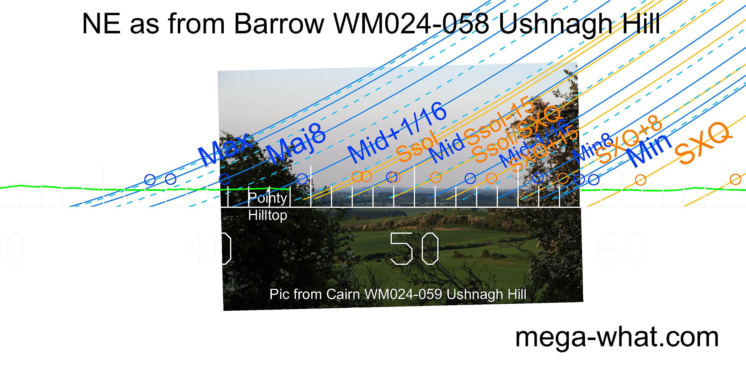 To the north-east, some distant hills provide markers for summer sunrises and part, at least, of the lunisticeLunistices are the most northerly and southerly moons of the month. The lunar equivalent of solstices - more.
range.
To the north-east, some distant hills provide markers for summer sunrises and part, at least, of the lunisticeLunistices are the most northerly and southerly moons of the month. The lunar equivalent of solstices - more.
range.
The eastern intersect of distant and local horizons is close to the equinox.
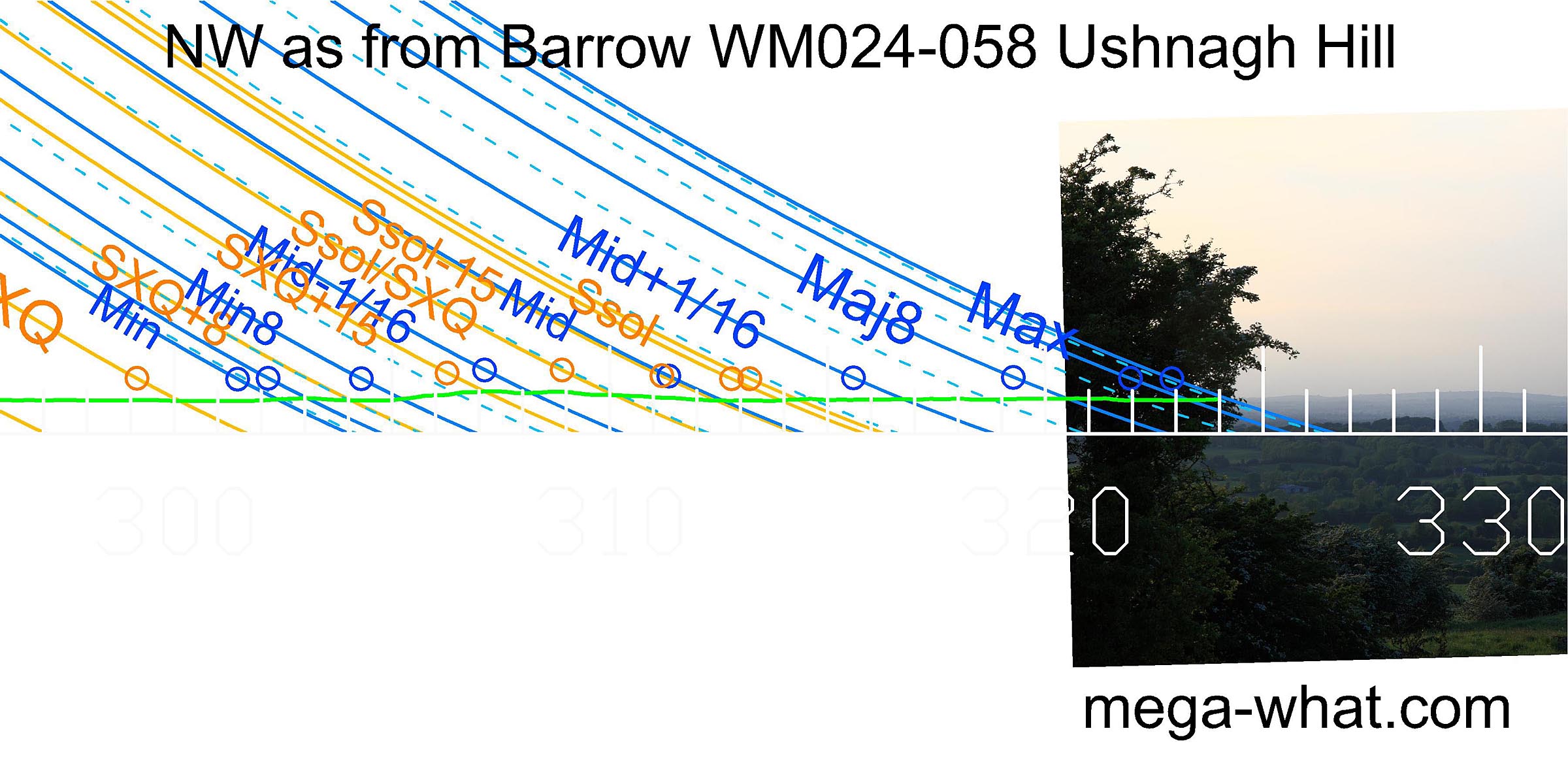 North-westwards a prominent hilltop is beyond the lunar limit.
Note that in all pictures on this page the azimuth scale has been inverted so that the continuous line is at Altitude/Elevation = -1°, while the tips of the unit ticks are at 0°.
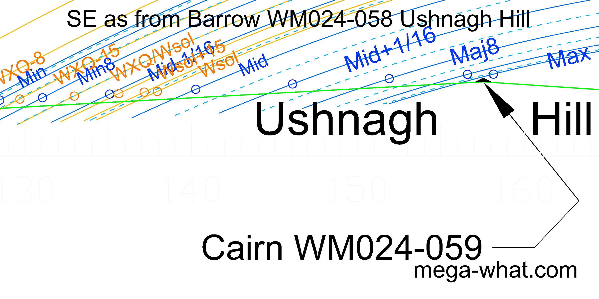 The Summit Cairn (WM024-059) of the hill may be seen above the barrow, on the horizon, c.110m to the south-south-east where it marks the major lunar limit.
Also (and more thoroughly) surveyed is Barrow WM024-061 (Cat Rock / Eriu's grave), 500m to the south.
References
- Archaeological Survey of Ireland, record details. www.archaeology.ie/archaeological-survey-ireland