
 This site is the summit cairn of the hill but it only got a brief visit in hazy conditions. Survey position was at its eastern end, beside the trig point, to optimise views between the bushes.
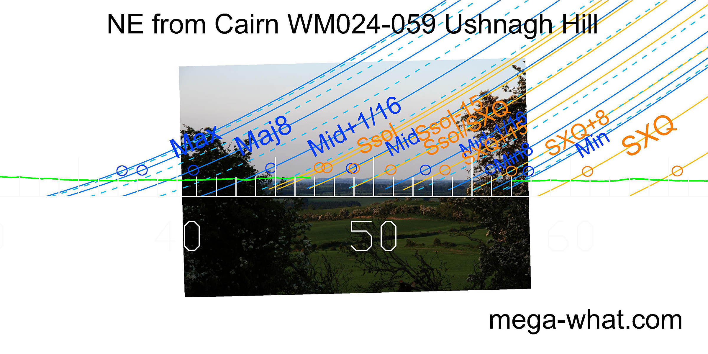
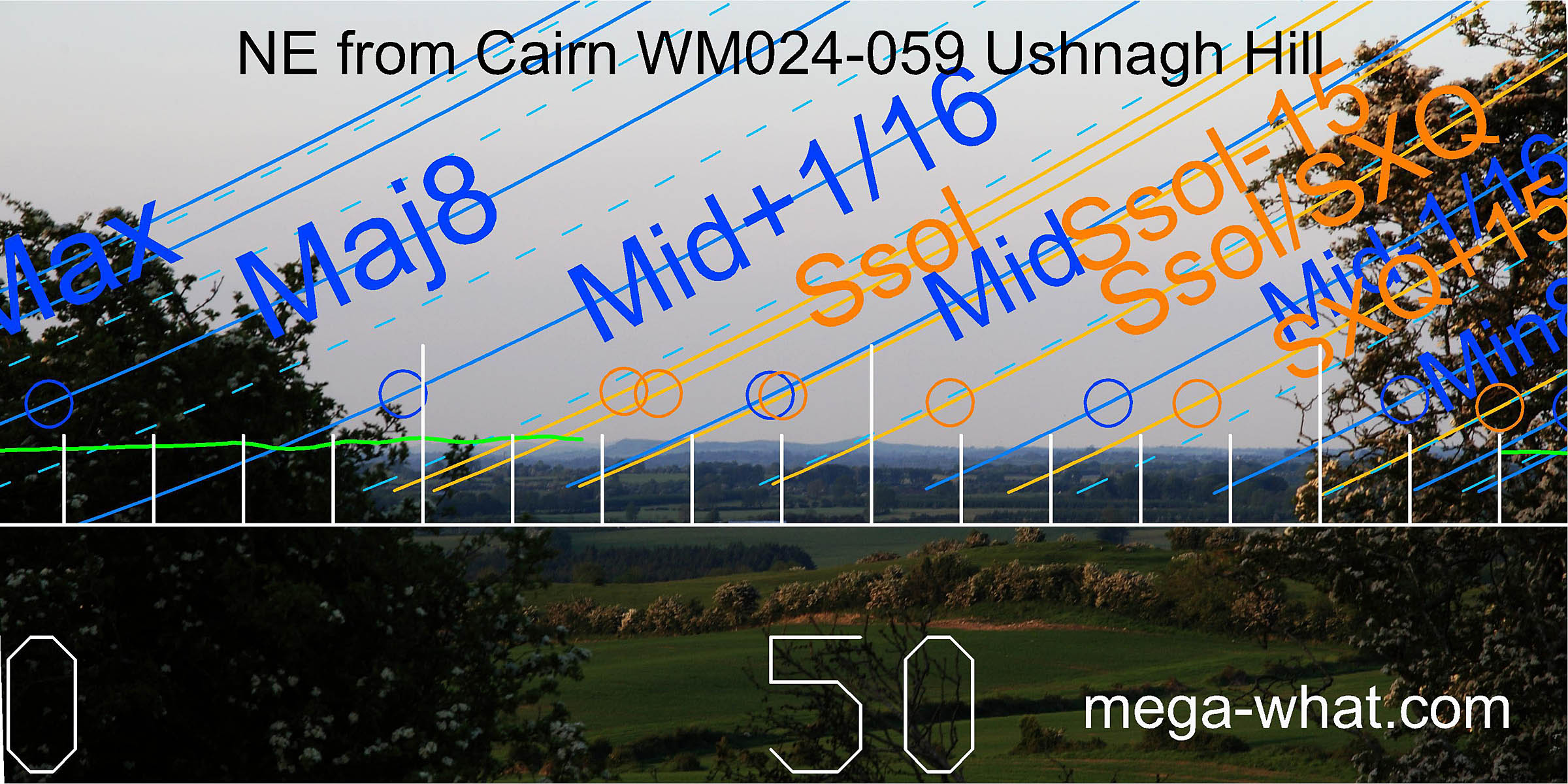
North-eastern views are curtailed by a hedge. Some distinctive hills provide markers for summer sunrises and part of the lunisticeLunistices are the most northerly and southerly moons of the month. The lunar equivalent of solstices - more. range.
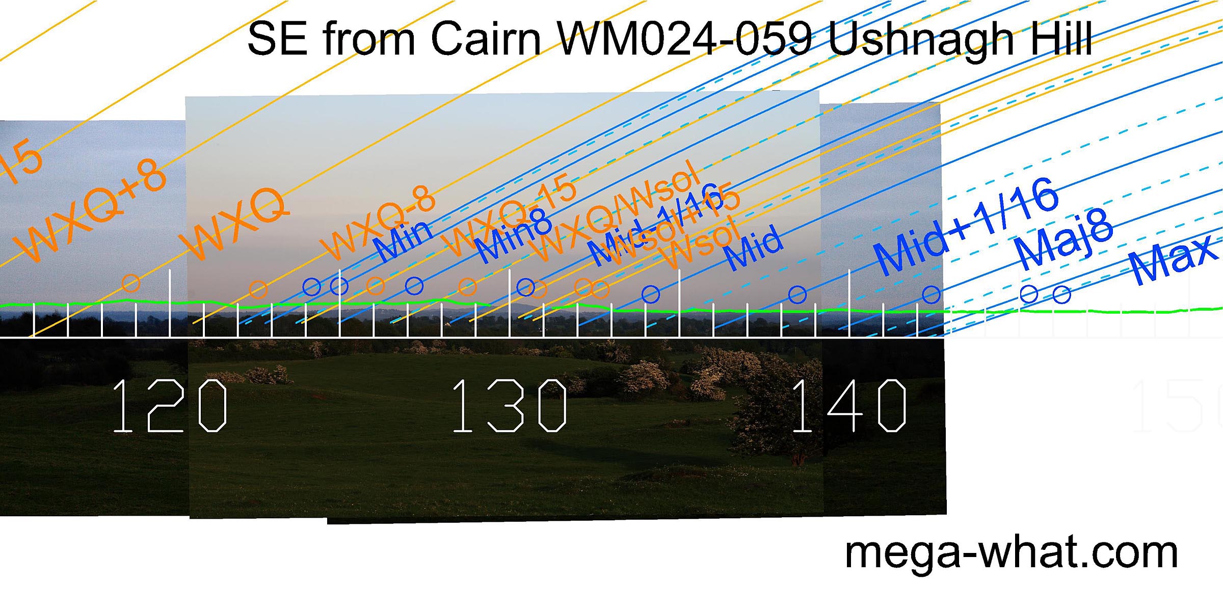
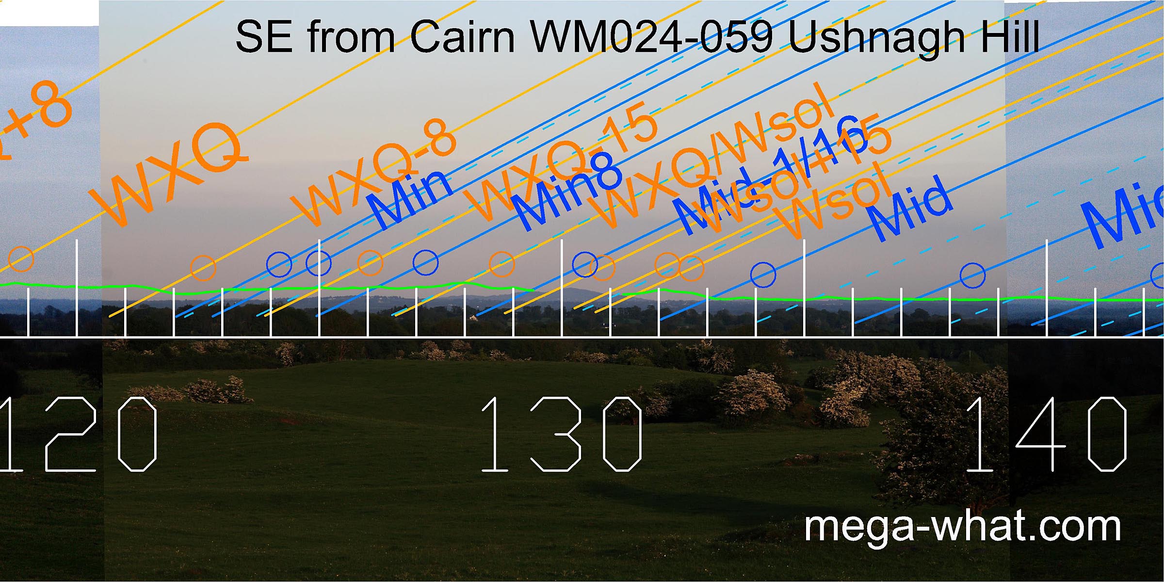 To the south-east is a prominent hill. The winter solstice is at its south foot, the half-month bracket on its summit and the solstice/cross-quarter midpoint is in its north basal dip.
There are also some useful lunar correspondences.
To the south-east is a prominent hill. The winter solstice is at its south foot, the half-month bracket on its summit and the solstice/cross-quarter midpoint is in its north basal dip.
There are also some useful lunar correspondences.
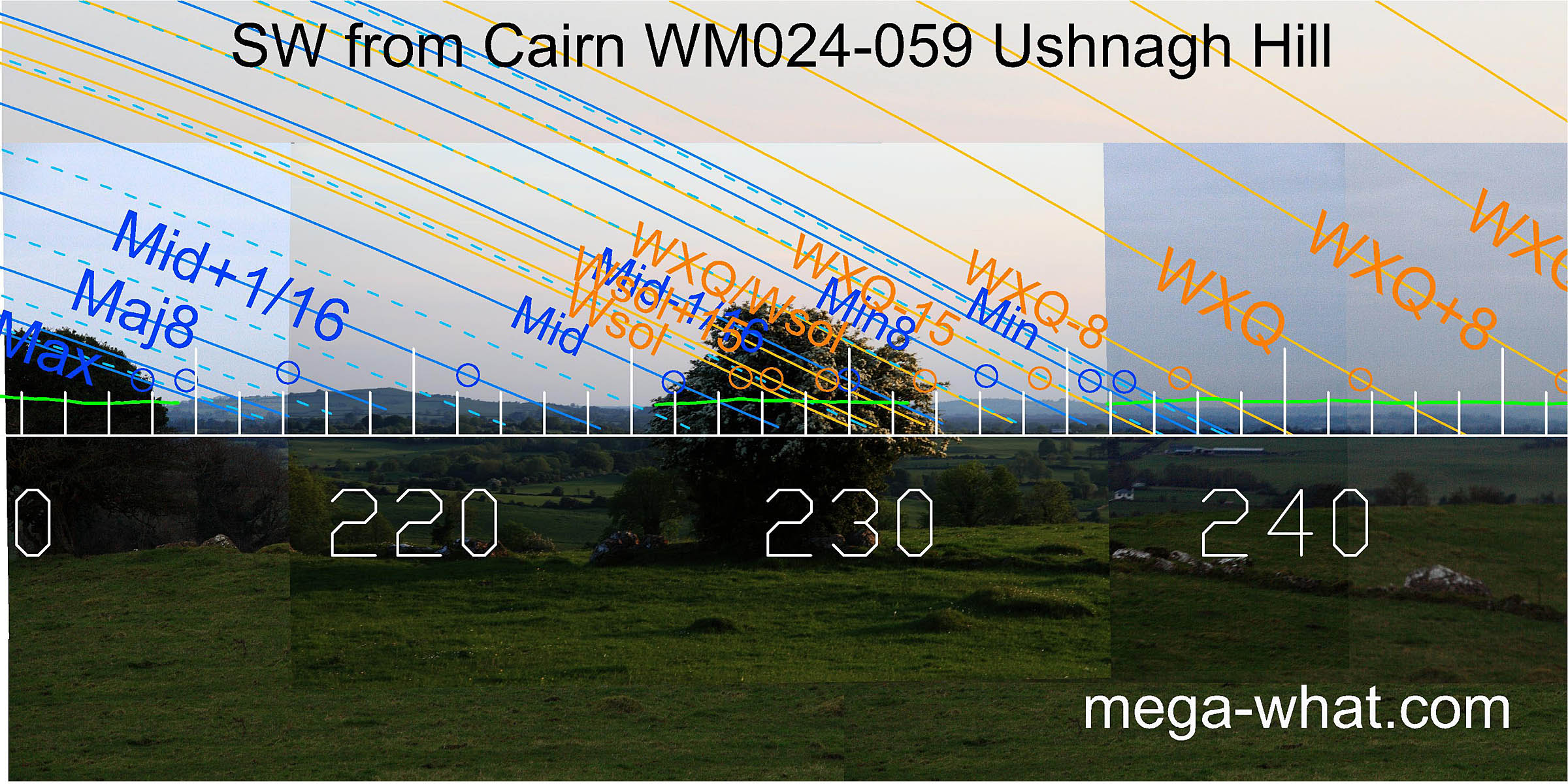 More hills in the south-west serve for the sets and it looks as if the lunar midpoint was in the dip between two hills while the winter solstice sunset was at the foot of the hill.
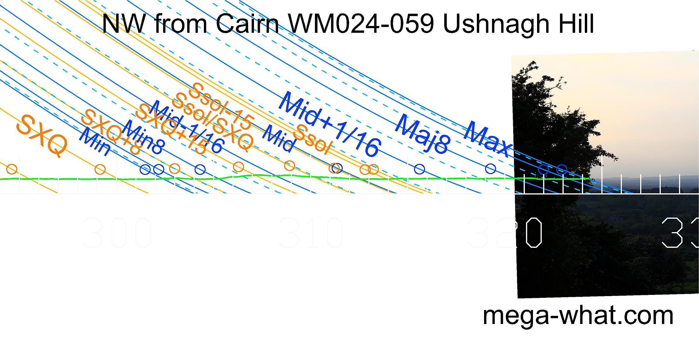
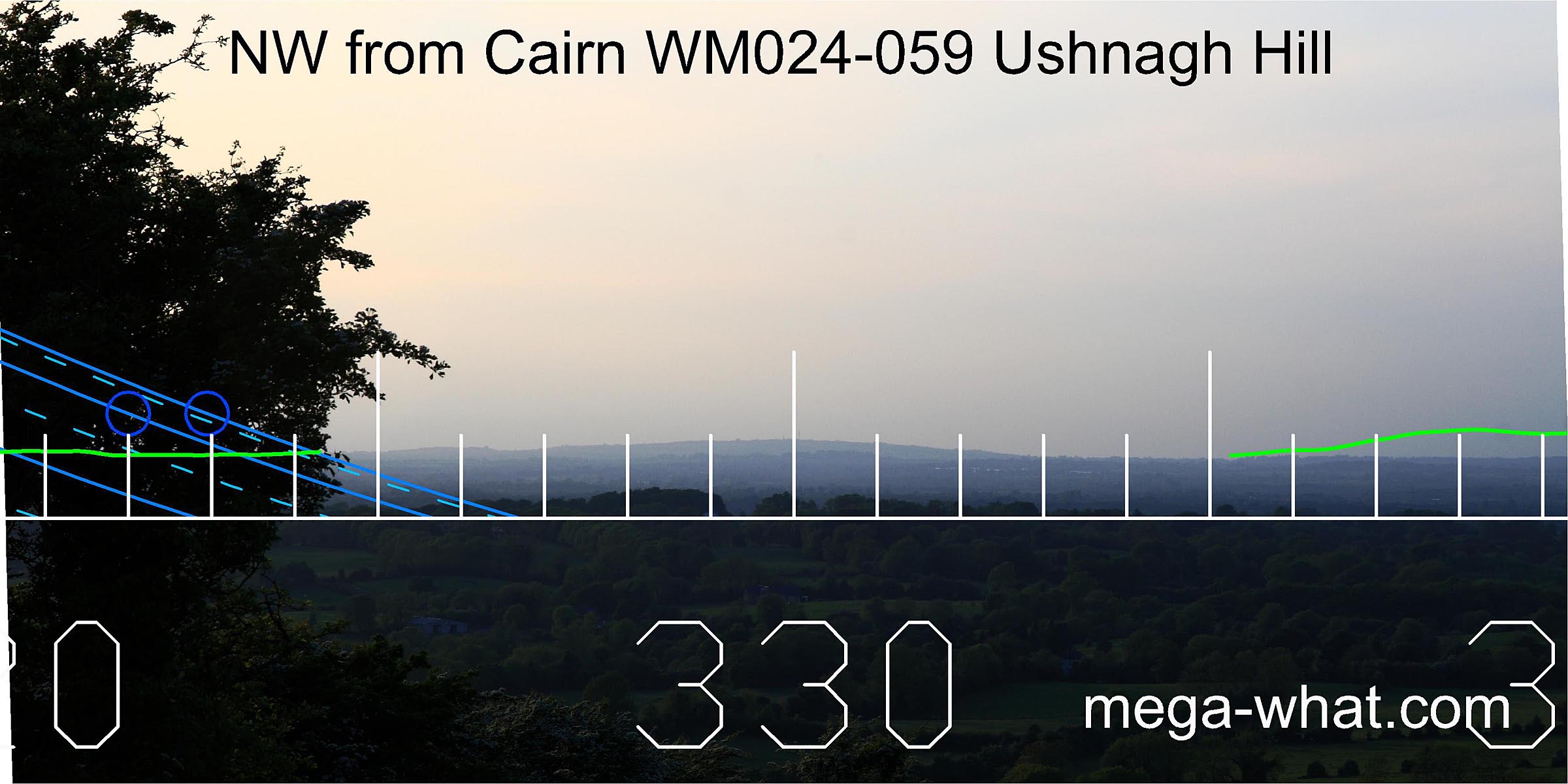 North-westwards this prominent hilltop is beyond the lunar limit.
Note that in all pictures on this page the azimuth scale has been inverted so that the continuous line is at Altitude/Elevation = -1°, while the tips of the unit ticks are at 0°.
Green lines approximate hidden horizon segments. They are based on computer generated data from HeyWhatsThat.com.
Other partially surveyed monuments in the area are:
- Barrow WM024-058 is 110m to the north-north-east.
- Barrow WM024-061 (Cat Rock / burial place of Eriu) is 420m to the south.
References
- Archaeological Survey of Ireland, record details. www.archaeology.ie/archaeological-survey-ireland